What I did on my Summer Vacation
OR
2003 Sierra Trip
By Douglas Van Bossuyt
As many of you know, every year my family goes hiking for between two and four weeks in the central Sierras. Due to this whole need to work and earn money, I wasn't able to go for the last two years. This last summer I decided that I would rather go out with my parents for two weeks than work and earn an income. Clearly, I made the right decision. What follows is a photo & text journal of the trip. No promises on spelling or grammar or much else for that matter!
Day One
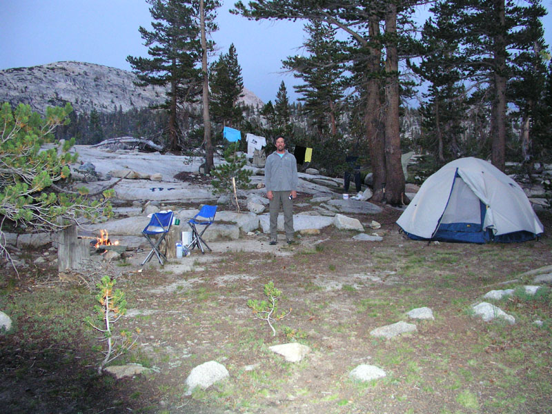
Camp Location: Post Corral Meadow
Altitude: 8300 Feet
Miles Hiked: 6.5
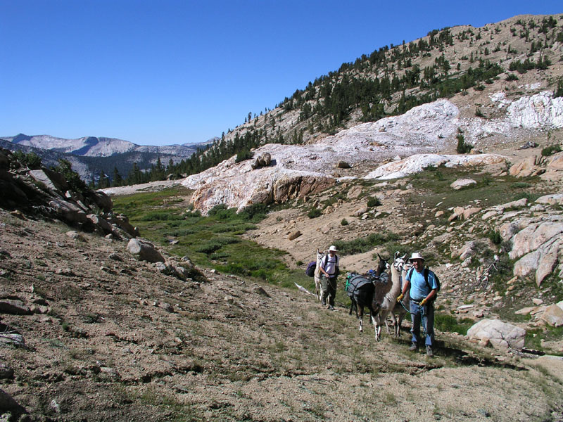
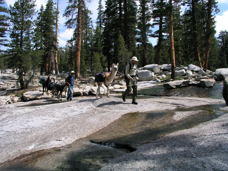
Finally! After three days of delays due to break problems with the truck, we made it to the mountains. The big red trailer pulled by the big white truck with brand new front rotors pulled out of my grandparents house at just after 8am. Two hours later, we arrived at the ranger station just outside of Prather. My parents went inside to pick up the wilderness permit. I waited with the rig, llamas, and gear.
A fire crew pulled up in an old beat-up school bus. The bus was full of city boys leading the easy life. One came over to talk to me and look at the llamas. He had hair jell and even aftershave! These boys clearly hadn't seen much action.
Once my parents came back, we piled into the truck and started up the new tollhouse grade. The very same grade that my great grandpa had helped build. As can be expected during the summer months in the central valley of California, it was HOT. 10am and we were already pushing 100 degrees. When we drove past the gas station at the top of the new tollhouse grade, the air temperature literally dropped 20 degrees. Windows were rolled down and arms extended in a very cowboyesque manner.
As usual, our truck was the tallest thing on the road. What gives with all these low-riders??
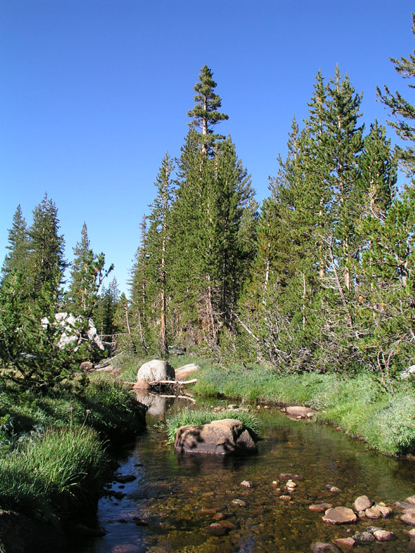
We barreled straight through Shaver Lake. No stops necessary. Our next port of call was Dinkey Creek Ranger Station where we stopped to fill up our MSR water bag. Nothing much had changed since the last time I laid eyes on the place in the summer time, about three years ago.
Following the water stop, we drove onward and upward through Mc Kinley Grove (where thar be redwoods) to the fork in the road where the avid outdoorsman chooses either to head for courtright reservoir (as I said, I cant spell) or wishawn reservoir. We chose the courtright road.
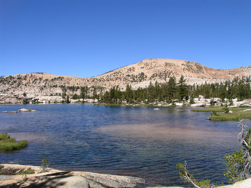
Courtright lake was about 20 feet down from full. Not too bad considering it was the middle of august. One of my great grandpas helped build this too. (that's great grandpa Douglas as I understand it). We drove over the top of the dam on the narrow one lane access road & around the side of a granite dome to the trailhead. There were 14 cars and one truck (ours). No other stock. When my parents used to be wilderness rangers in this area in the 70's, most days saw at least 70 cars. Some of this drop-off can be attributed to California’s schools starting a few days previous to our arrival but in California, unlike Oregon, outdoor recreation has dropped off in recent years.
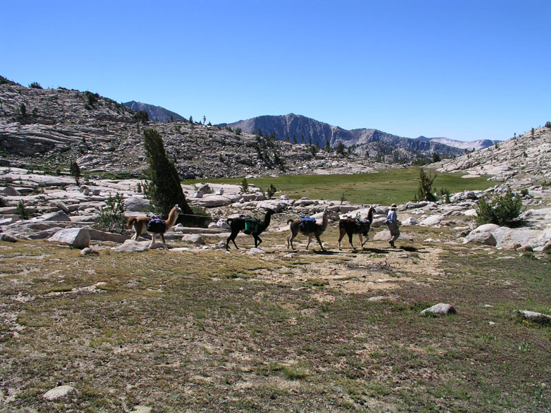
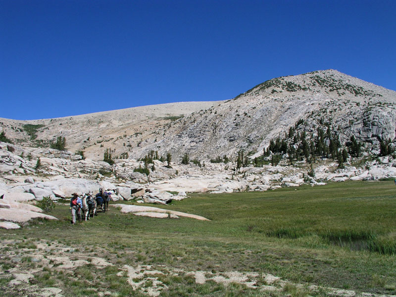
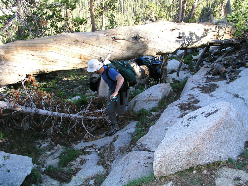
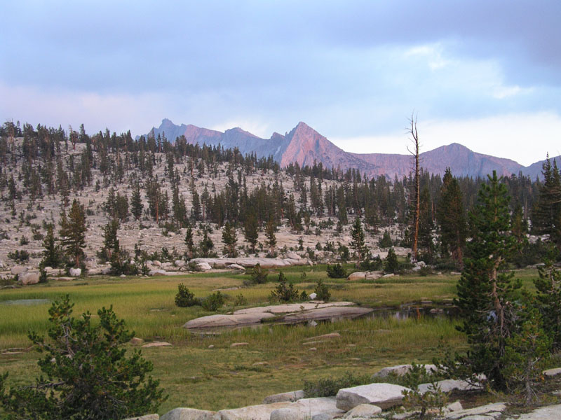
Some lunch was had at the truck, llamas were loaded as well as humans, and we hit the trail at high noon. Our group hit Chamberlain’s Camp in an hour flat. From the trailhead to chamberlain’s it's about 2 miles or maybe a little more. There was a brief stop at the bottom of Chamberlain’s hill & then we headed up the hill. In under 30 minutes we were on top and started down the other side. That's really good considering the top of the hill is at 9000 feet and the bottom is at 8500 or so. Elevation DOES make a difference. The weather was a bit cloudy with some darker thunderheads building back toward Evolution Valley in Kings Canyon National Park.
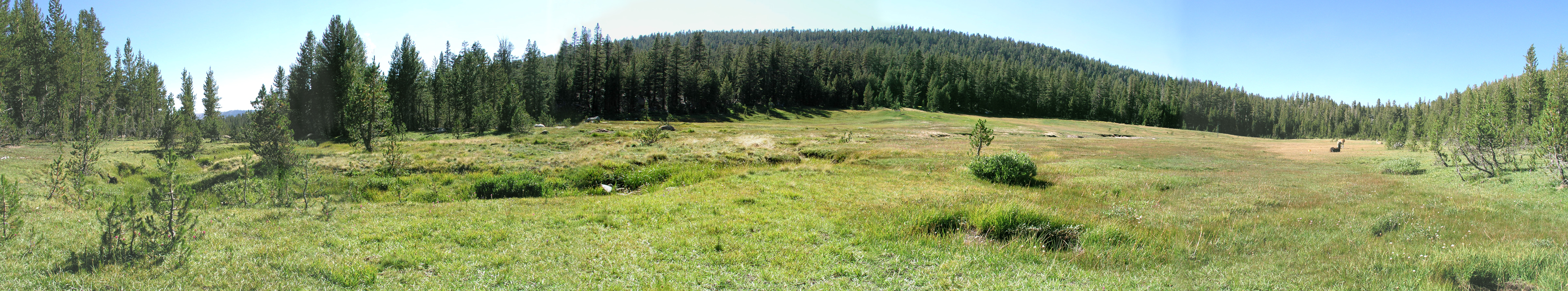
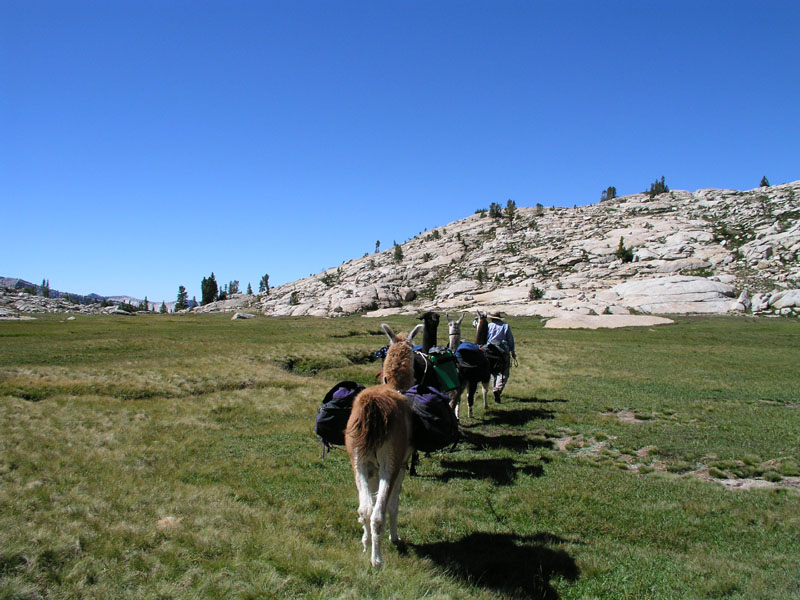
We stopped for a sit down - load off break at the top end of long meadow. The llamas were very happy to have lots of succulent green high altitude meadow grass & pine trees in great abundance. Slim pickings were had over the previous days in Fresno.
The break lasted about 20 minutes then back on with the loads and down the trail to Post Corral. Since our truck had been kaput for several days & thus we had been delayed in starting our trip, we were headed to post corral, rather than our original plan of red rock basin. The original trip had called for an extra two basins. Now we were planning for a little more compacted trip.
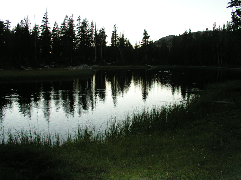
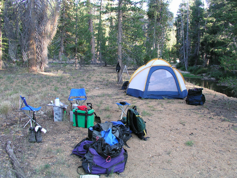
We pulled into our usual campsite at 4:15. Total distance hiked was around 6.5 miles. Not too shabby considering I was carrying just shy of 38 lbs in my backpack at more than 8000 feet without any time for acclimation!
Post Corral is nearly the lowest point on our trip. We'll hit right on 8000 feet coming out of the North Fork of the Kings river but this is the lowest camp we have planned. Tomorrow we head for Devils Punch Bowl Lake in Red Mountain Basin & maybe even as far as Meadow Brook.
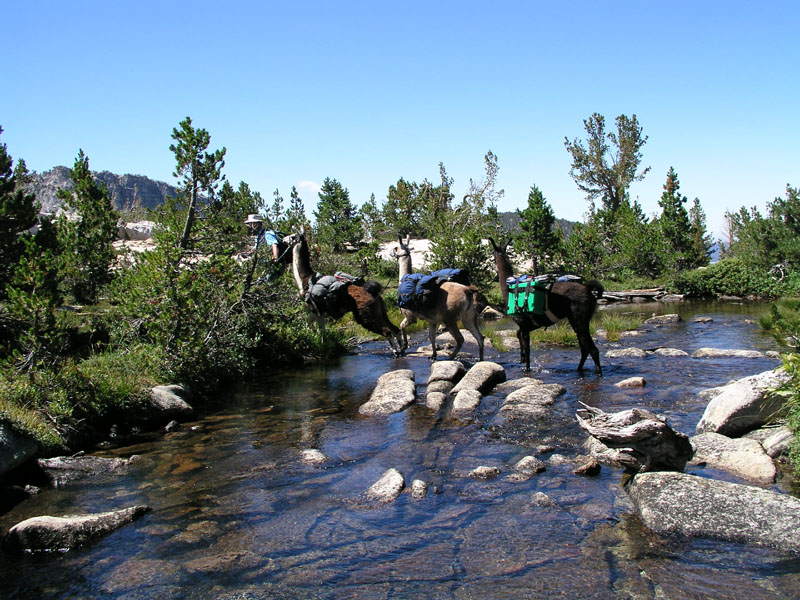
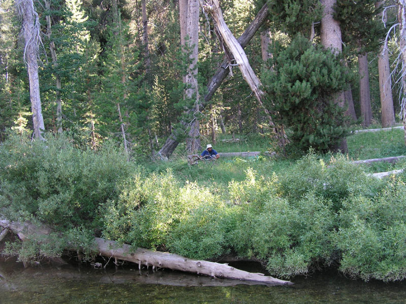
Coming into post corral meadow, we got rained on for about 20 minutes. Not enough to make us put on rain gear but enough to keep the dust down which is good because I was behind the string of llamas leading our youngest and most inexperienced llama, Chaco. He should have been going first, for training purposes, but he had decided that he would rather be rear guard. We also heard 10 or 15 good rolls of thunder. Some sounded cloud to cloud and some sounded cloud to ground. This is the first time in several years we've had any weather to speak of. I hope we get some more exciting weather! well as long as most of the days are sunny so I can work on my tan. LOL.
For dinner, I had some sort of noodle & chicken freeze dried mountain house meal. It was fair to okay. As I sit here in camp, I can see a piece of white nylon rope stuck on a branch in a tree a little piece away. Someone's piss poor attempt to hang their food so that bears wouldn't bother it. We are just going to put all the food into the vestibule along with the rest of our gear for the night. If a bear comes around, the llamas will let us know far in advance of any camp incursions.
The clouds have now pretty much broken up & promises of a good sunset are being made. I shall have to get the camera out and take some photos. A clark's nutcracker just flew over making the typical racket that they do. West Nile Virus will wipe them out once it reaches here. They may be pesky at times but the woods will be a whole lot lonelier without them. Speaking of quiet, I forgot how nice it is up here. No cars to make noise, no people to chatter endlessly, only one or two jets now and then but even then, only for a few seconds. The best thing above all is that there is no 60 HZ hum! NONE! As far as I am concerned, AC electricity is the plague of our modern society. Never are we without the comforting, yet hollow hum of the power grid. Well at least not in the low country.
The sun set isn't turning out that great tonight. I'll take a few pictures just the same.
Day Two
Camp Location: Flemming Meadow
Altitude: 9790 Feet
Miles Hiked: 6.5
Today was a very exciting weather day! I woke up somewhere around 630am & got out of the tent. There were already clouds! The clouds weren’t thick but covered a good portion of the sky. For breakfast, I had some granola & tea. Much to my dismay, I discovered that our tea selection is rather lacking. Due to this fact, I just stuck with some mint tea. It was good, but I really am missing the much larger selection of teas that I have to choose from at home.
We tore down camp and got underway by 9:15. There were already several thunder clouds building by courtright and burnt corral. We headed up the trail for Red Mountain Basin. Just before the blasted rock section of the trail up out of post corral, our train stopped so that daddieo (my dad) could fill up the MSR bag with water from a hidden spring. Some years when post corral is overflowing it's banks, we hike up to the blasted rock and camp by the spring. Today though, we just got water.
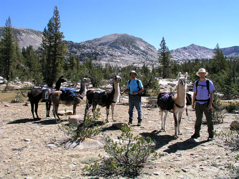
Momma (my mom) got out the video and digital cameras and took some photage of us crossing the blasted granite. Climbing from Post Corral to the top of the pass is a total of about 1400 feet of elevation gain in about 2 miles. 3/4 of the way up, we met a family from Munchen. They had been backpacking up in Red Mountain Basin for a few days while on holiday in America. The family had never seen llamas before. Thusly, pictures were taken and llamas were petted.
By now the clouds were building pretty good and had ominous looks in their dark underbellies.
A spell further on, we ran into a guy, his son, and his son's son coming down the trail. They had also (also had?) been up in the basin.
We got to the top of the pass in one hour 45 minutes. I went to the edge and took some pictures while momma and daddieo got out some snacky snacks & liquid refreshment of the type common on camping excursions. (IE water & Gatorade). It was yummy.
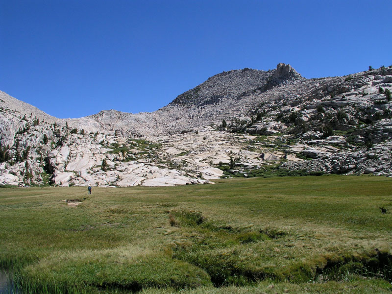
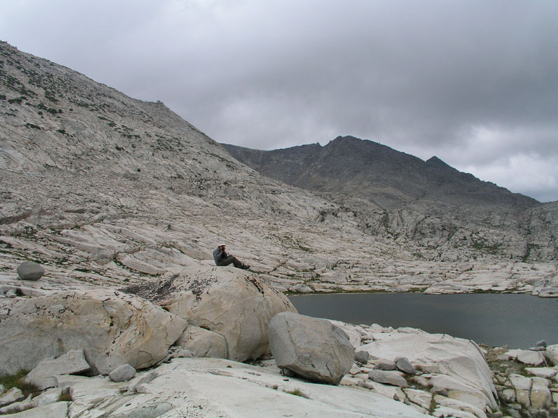
Post-snack and water break, our merry party of llamas and humans struck out once again toward the cutoff for Devil's Punchbowl. By this point, the clouds looked rather angry. We even felt a few drops of rain. Prudence took the upper hand and we decided make for Flemming Lake instead of the punchbowl. Devils Punch Bowl sits in an exposed location at the lip of a substantial drop off. To get to it via the cutoff, one has to cross great expanses of exposed granite. Not a happy place to be in a storm!
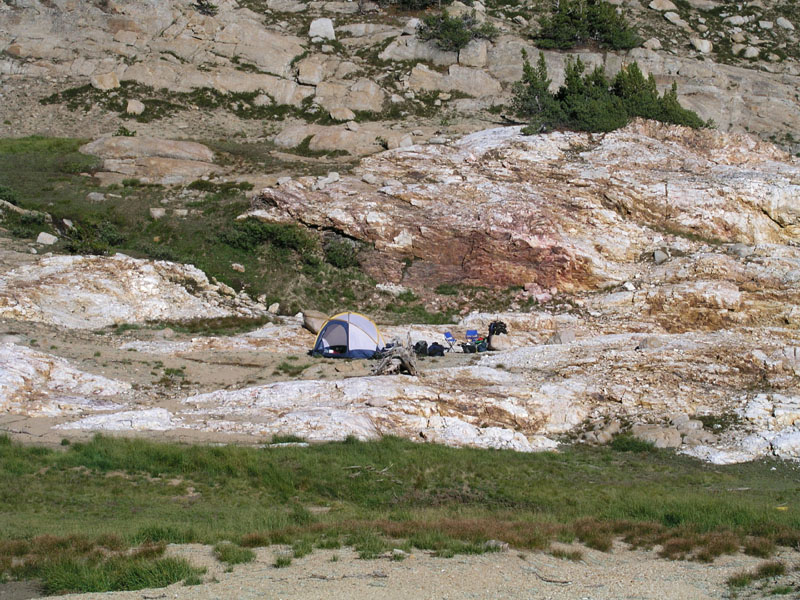
The string pulled into Fleming Lake right at lunchtime. We ambled on over toward our normal campsite only to run into a very queer individual. He looked about 60-70 years old and was wearing a bright orange down coat. He asked us where we had come from and said "you couldn’t have come from there!(post corral) We came from post corral and the trail goes over there (points in a different direction)" Anyway he was very strange & in our campsite! The decision was made to head around the lake a little farther and stop for some lunch. The odd fellow followed us over & talked to us with long awkward pauses in the conversation. Pauses created by us trying to give him the hint to leave.
Once finished with food, we loaded up again and told the odd orange guy that our group was headed for Dale Lake. About 1/4 to 1/2 of a mile farther up the trail in Flemming Meadow, we decided the sky looked down right pissed off & pulled off the trail in an old campsite which we had last visited in 1986. The tent was hurriedly erected & the fly was thrown on. Hatches were battened as the sky looked ready to storm. A few drops fell but not much, so we got back out of the tent & lay in the sun. I felt dehydrated so I ate about a table spoon of salt and drank a quart of water.
The sucker-hole in the clouds moved on to the north and it began to get dark. I got in the tent and promptly fell asleep (due to the dehydration). About an hour later, I awoke to the sound of pounding rain. It had started raining quite hard right after I fell asleep. I still felt a bit woozy, most likely altitude sickness, this being the highest I had been in several years.
At the front of the tent where the vestibule is, there was a lake of water. Our bags were getting wet! Luckily everything is double bagged with garbage bags just in case something like this occurs. Daddieo put on great amounts of water repelling clothing and got out of the tent into the storm to dig trenches to aid in draining of the lake. I took some photos and some video.
Lightning and thunder started cracking all around the basin as the rain picked up its pace still further. The ground couldn’t absorb the water fast enough. Everywhere I looked, there was an inch or more of water running along the ground. After a while, once more moats and canals were dug, daddieo got back in, now very wet even in spite of the rain gear.
We sat in the tent another hour or so listening to the thunder and counting seconds between flash & crash. The closest we counted struck just under a mile away. From what we heard, Dale Lake and Devils Punchbowl were both getting pounded with rain and lightning. At about 5, I got fed up with the tent and got out into the rain. After so much moisture, the levies & dikes needed reinforcement. The tent fly also needed to be tightened. All of the llamas were rather bedraggled looking. The resembled drowned rats or poodles that had gotten left out when the sprinklers turned on.
Finally the rain let up at about 6pm. Momma and daddieo got out and made some hot water for dinner. I had stroganoff or some reasonable facsimile. Freeze dried of course. The clouds continued to look ominous and grumbled at length with cloud to cloud lightning until about 730pm when things started breaking up. I got out the camera and took some nice sky shots and whatnot.
It's dark now. There are a few patches of stars in an otherwise inky black sky. This would be a great place to watch the stars, save for these clouds which are trucking on through headed to Oregon. The whole lot of clouds is going south to north, keeping us guessing as to what might be coming next.
Tomorrow we will try and make it to meadow brook before things get nasty. This extra day wasn't planned so our trip shall adjust as necessary. Possibly we'll skip crown basin or stay only one night in Black Cap Basin. In two days we'll be at the quartz pillow. Hopefully I'll be able to climb Mount Hutton (12001 feet). At the quarts pillow I’ll also search for some good pieces of clear quartz to give as gifts. It's very dark now. Time for some sleep.
Day Three
Camp Location: Second Meadow Down Meadow Brook Trail
Altitude: 9840 Feet
Miles Hiked: About 5
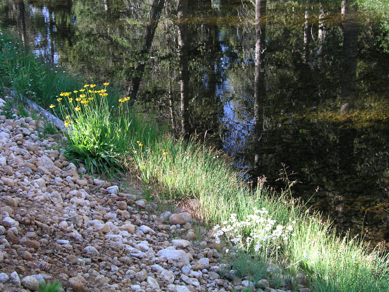
We woke up to a clear sky. The rain of the previous day had pushed the smog layer far down into the valley providing us with a deep blue dome over our heads. Of course everything was soaked from several inches of rain. I went over to the creek to take some pictures of how beautiful everything was only to discover that all of the pictures we had taken up to this point had mysteriously vanished! about the only thing I can think of is that the electrical storm freaked the camera out and made it wipe the compact flash card. this is why there are no photos up to this point.
Deep blue sky
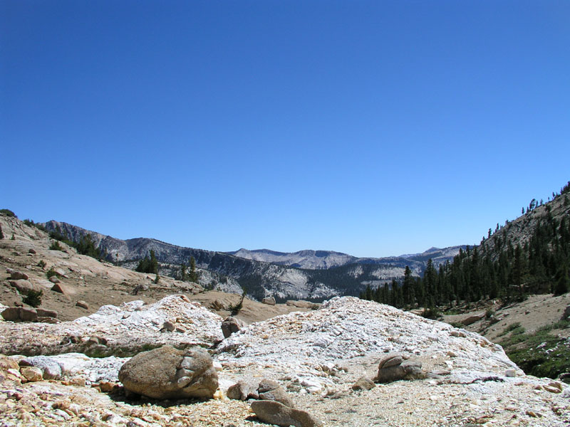
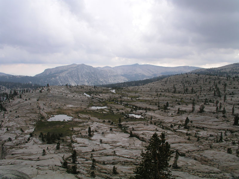
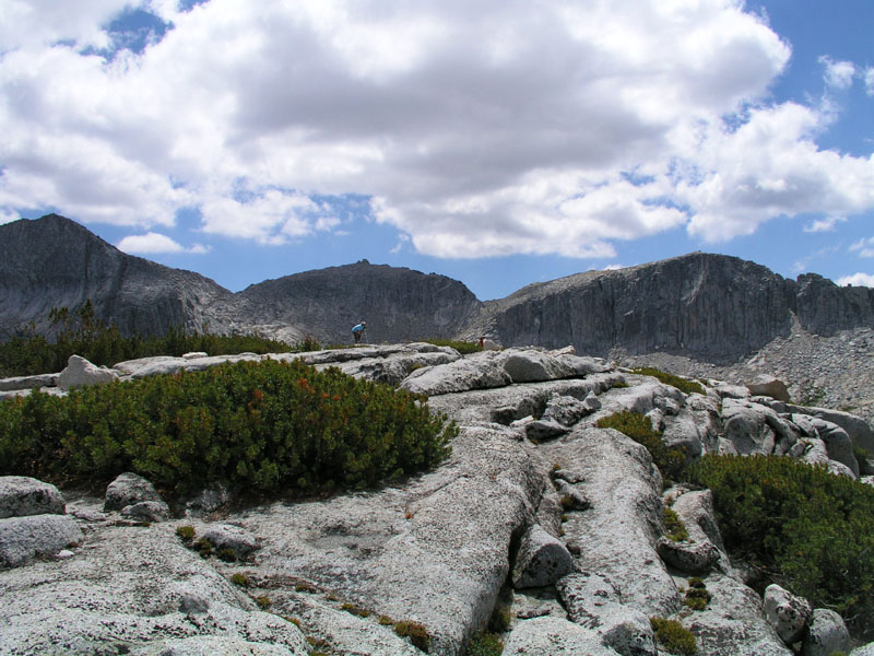
We dried out what we could and loaded everything up. Camp was left at 10:15 or maybe a shade before. The trail toward Hell For Sure Pass winds up over the first ridgeline on the way to Hell For Sure Lake. We went up to the first bench, non-stop, in just under 30 minutes. A new record for humans and llamas alike! The llamas decided we needed a break just over the top of that first ridge in a big open space. I proceeded to take copious photage of the place. Had we not lost all those pictures from the first two days, we would be pushing 100 photos in 3 days time. God I love digital photography!
Taking a break on the ridge
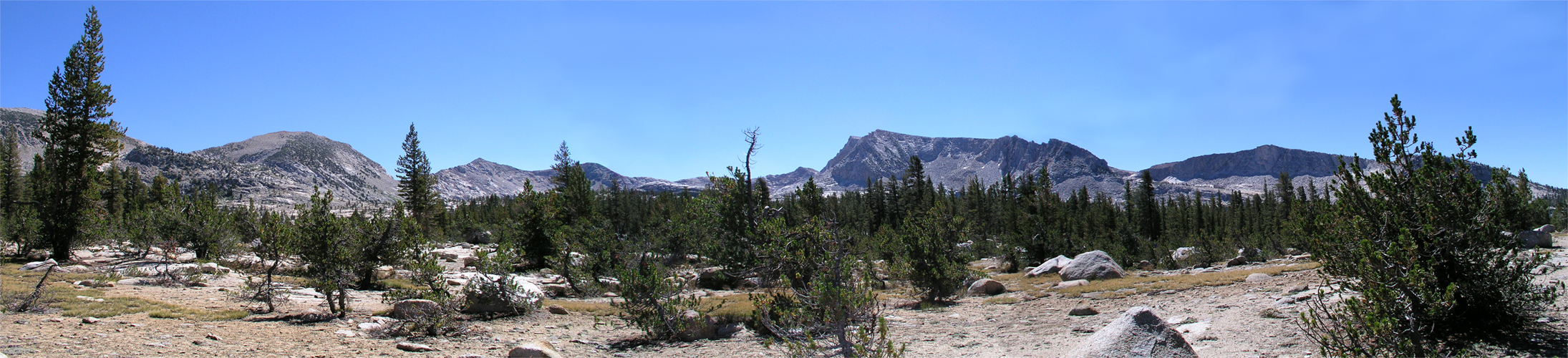
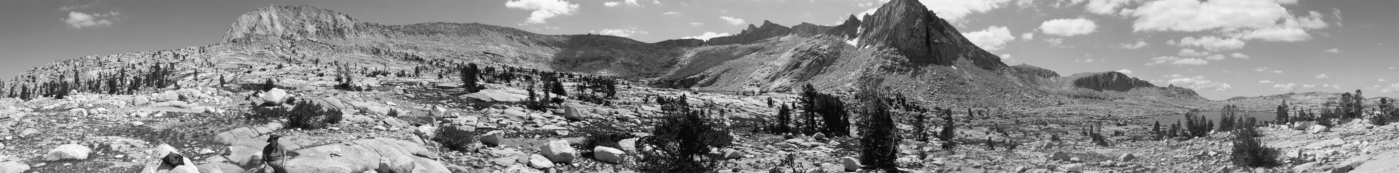
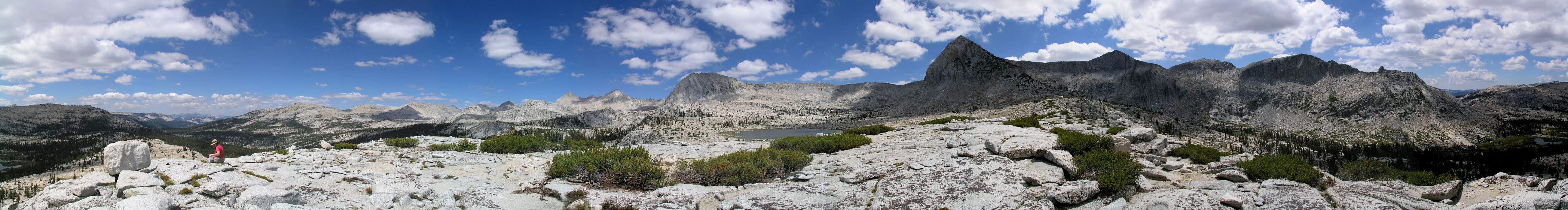
Panorama of Upper Red Mountain Basin. (scroll to the right for full panorama)
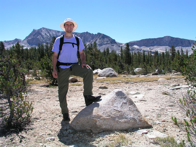
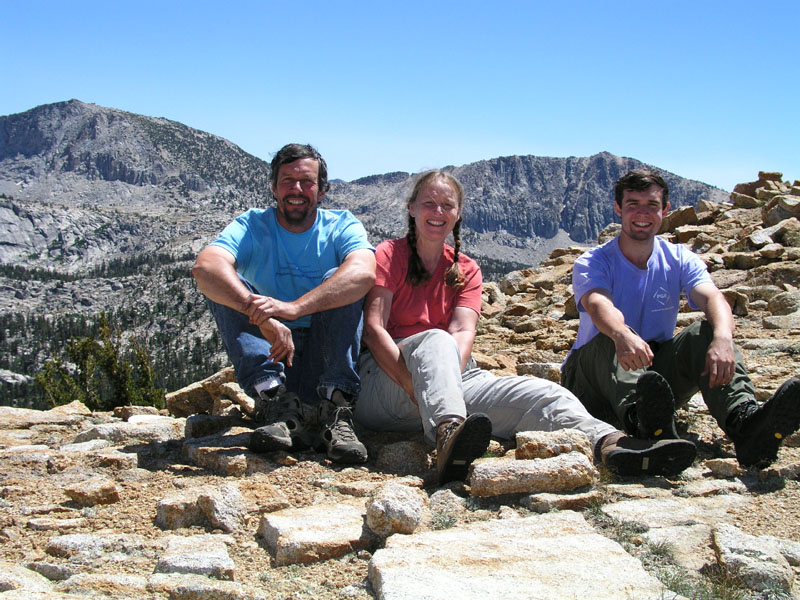
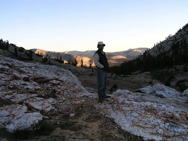
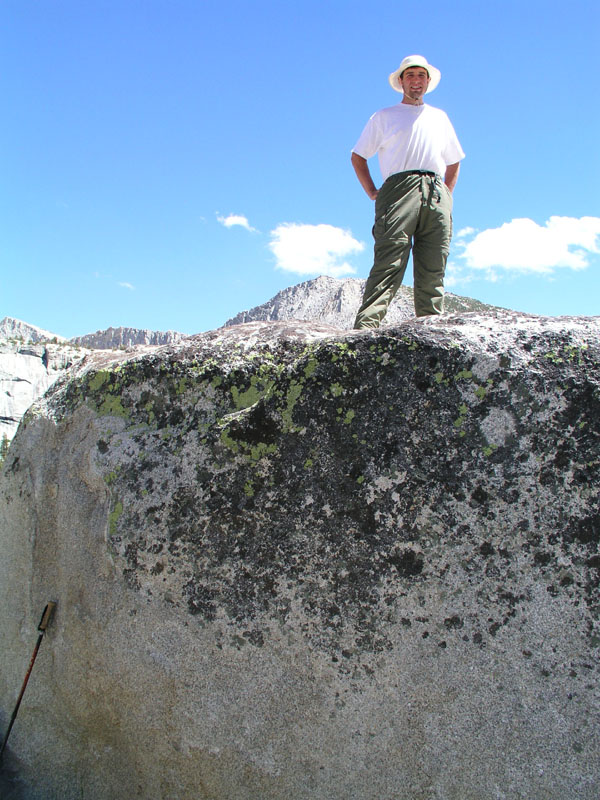
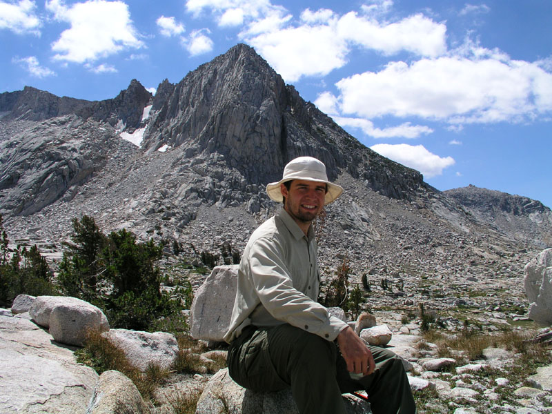
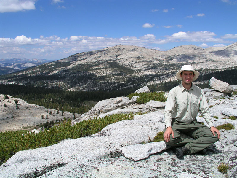
Me
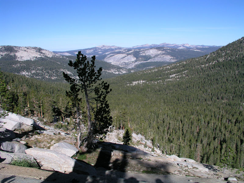
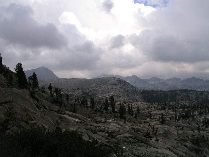
Up on the exposed granite, where we now were, the wind was constant and loud. The sky was still a magnificent deep blue with nary a cloud in sight. The smog layer was barely visible waaaaayyy down in the valley, where it should be!
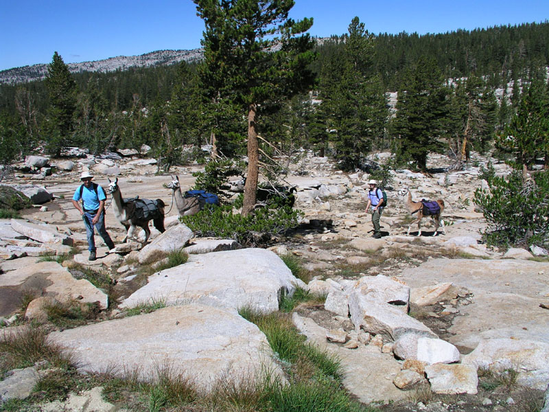
Heading across some bare granite
Our caravan continued on the trail to Disappointment Lake. Some more pictures were taken & then we headed along the northern shore. On a little ridge overlooking disappointment lake, we saw a 2 man tent & some backpacks. No people though. They probably were day hiking to some other lakes.
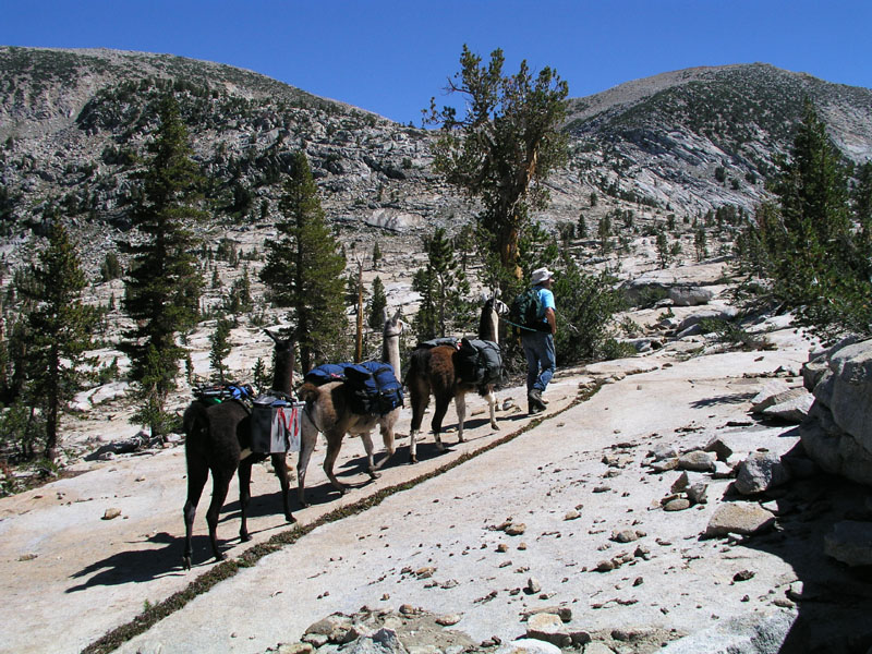
On the trail to Disappointment
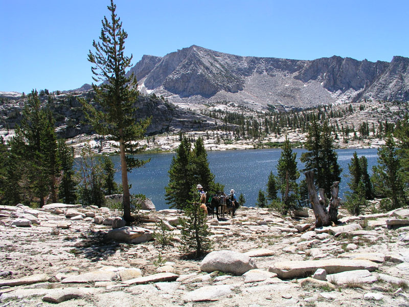
Disappointment Lake
Crossing the outlet at the bottom of Disappointment
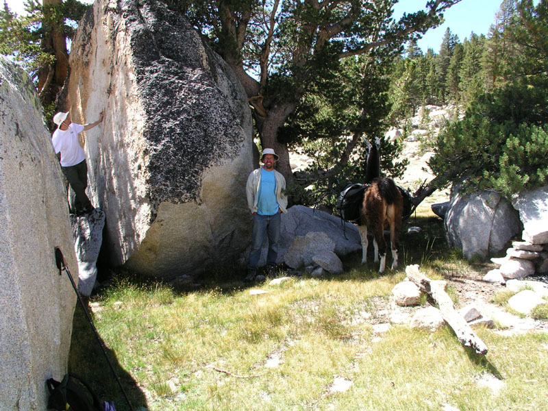
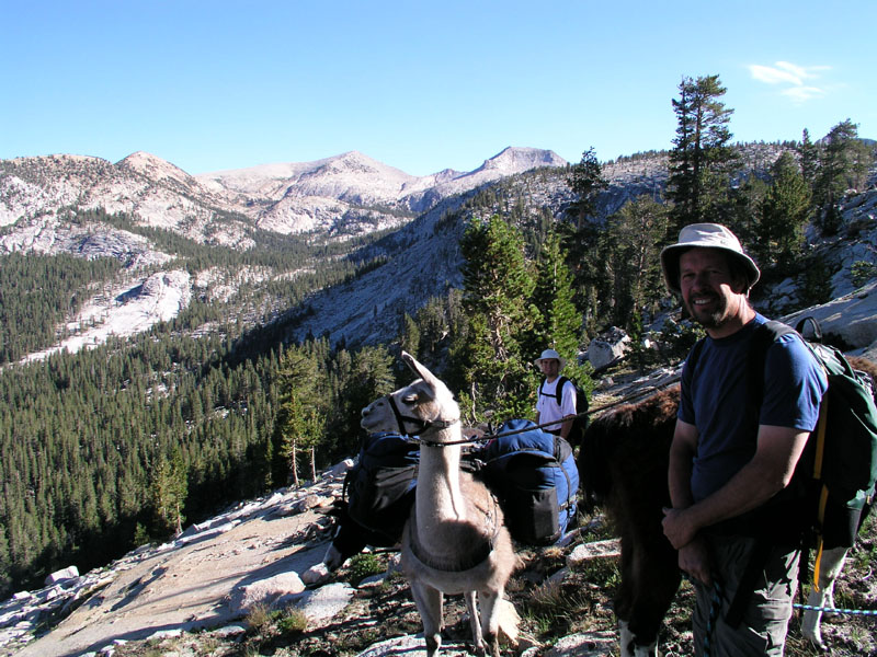
Continuing on from the backpacker encampment, we wound our way through the exposed granite filled with cracks, faults, and fissures to a little grass filled gully where it was decided we should stop for lunch. As we went to unload the llamas, Goddard (the llama, not the nearly 14000 foot tall mountain) tripped, fell over, and landed upside down! He has been carrying the aluminum boxes with our kitchen and food contained within. Goddard managed to get wedged on his back between the two boxes and saddle so that his legs were sticking straight up in the air! That llama, who's heart is bigger than his brain, flailed about a bit until momma calmed him down by talking to & petting him. I pulled the quick releases on the box & we rolled him back over. He was none the worse for wear, thankfully, as he was carrying about 70 lbs of gear! Also, what would we have done with out our loveable Goddard?
We ate our lunch up above the llamas on one of the many granite outcroppings to provide a better view which as we all know, aids in digestion. I got the camera and tripod out and did some photographic work. My dad got the video camera out and we did a bit of that too. After food and photos, we loaded up and headed on around the ridgeline/precipice edge angling toward bigshot and little shot lakes. Crashing through the brush on this cross-country route, our party managed to startle several does and their fawns.
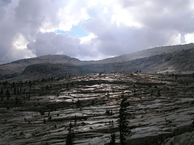
Evidence of the previous day's storm was everywhere. In many places there were banks of hail several inches deep under a layer of pine needles that had been washed down the rocks. Once on top of the ridgeline to the north of the punchbowl, a nice view of the surrounding country through a loose stand of pines was had. Down the ridgeline we went toward the lake. It was very windy. Very pretty. Photos were taken on the way down in multiple mediums. A brief stop at the Punchbowl was made for more pictures and such in every format imaginable, then back on the trail once again, toward Meadowbrook.
The trail from the punchbowl over the ridgeline and into Meadowbrook is pretty sketchy. Luckily there were whole flocks of rock ducks to mark any number of trail routes that we could take. The llamas smelled the sweet grass of Meadowbrook ahead & started pushing on us to go faster. We came down to the second meadow from the top & pulled into a camping site which we had used on a previous occasion.
A tree had fallen across our normal tent spot so we were forced to make a new home for the tent. Daddieo got out the saw and hacked up a good portion of the top of the tree to make it easier for us to go and come from the meadow. We found some fresh bear droppings near the camp. It appears there's a resident bear in these meadows.
Due to the previous night's soaking, all of our bags had to be emptied and everything was laid out to dry. We lost some Pepto-Bismol and some paper boxes but otherwise the plastic bags saved the day. While stuff dried out, I went and got wet down in the creek that runs through the meadow. It felt good to give myself a bit of a bath. Afterwards, I sprawled out in the grass with just my boxers made into a very grotesque thong-like apparition to get some sun. I want to make sure I’m looking good when I get back to Newberg! My arms and face are already quite tan after only a few days so I figured that it was time to give some color to the rest of my body.
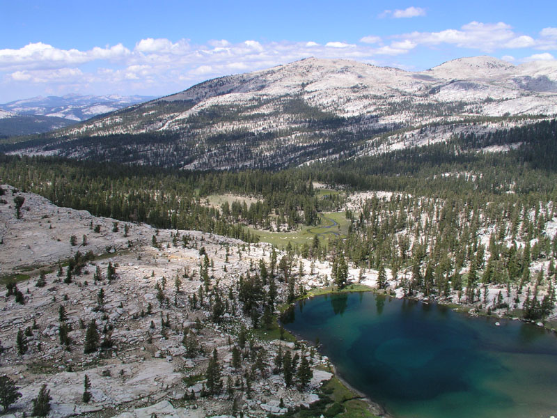
Meadow Brook Panorama
Meadow Brook Camp
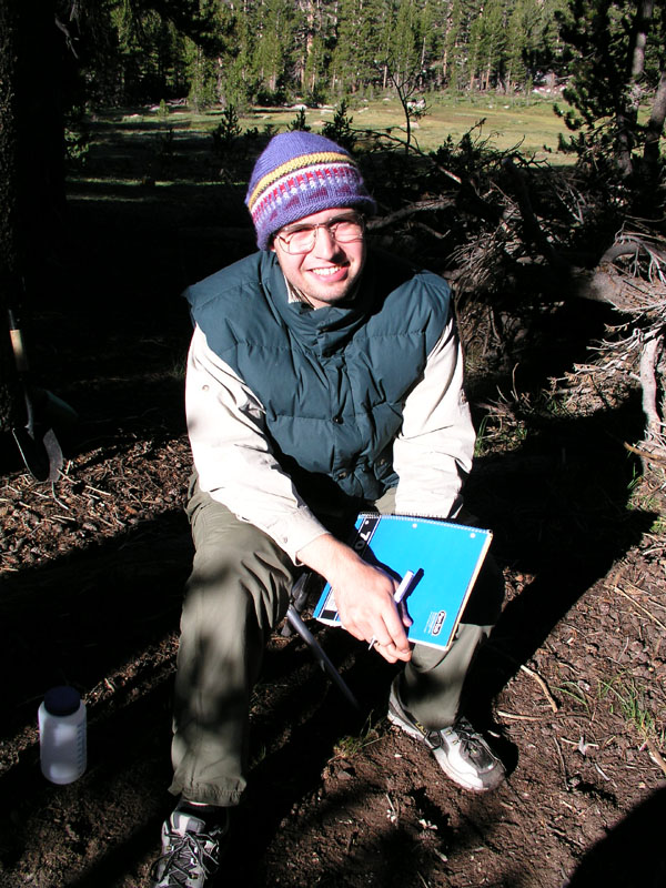
Me, my cap, and my writing
Now it's night and I'm drinking some chamomile tea. I had a marshmallow, chocolate & graham cracker (a "smore") after dinner. Tomorrow we are going to the quartz pillow & bench valley. I shall be sure to find some marvelous rocks for some marvelous people. My backpack is under 30 lbs now so I can put a good 20 lbs of rock & still manage to make it down the trail.
Day Four
Camp Location: Quartz Pillow
Altitude: 10605 Feet
Miles Hiked: 4
Feet climbed: 1200
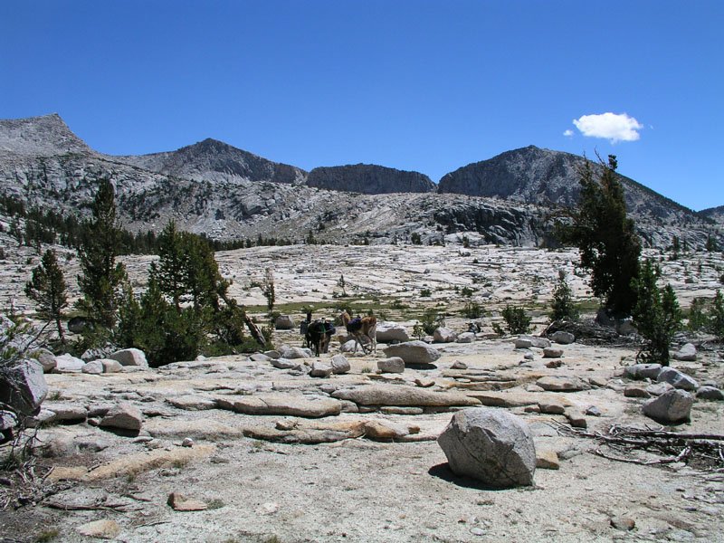
We got up at Meadow Brook this morning & had bread-on-a-stick. Of course with honey and butter. Yum. We left around 9:30 & set out for Bench Valley. The cross country route goes through an open forest along the side of a ridge separating Meadowbrook proper from meadow brook basin. After about an hour, we came to a boulder field. It took us a while to find a way through the jumble. The boulder field extends down the nose of the ridge for about half a mile. We crossed at the bottom just before the earth falls away to nothingness.
The next obstacle was a large washed out creek complex. Good thing llamas are sure footed! the whole complex is about 1/4 of a mile wide and a mile long (up the basin). Once we got past that mess, we went up to the first in a series of meadows going up the basin. There's a pretty little spring in the middle of the grass with a brook flowing out. Our troupe stopped for a snack & a load off break. There had been a small hunter camp at the bottom end of this meadow. Daddieo found some horse feces (very old) and some blue bailing twine. When the hungers had been there, it must have been very cold, because they had two fire rings with enough room between them to sit.
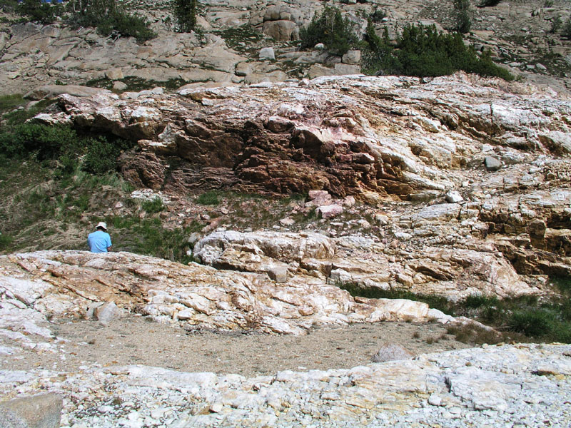
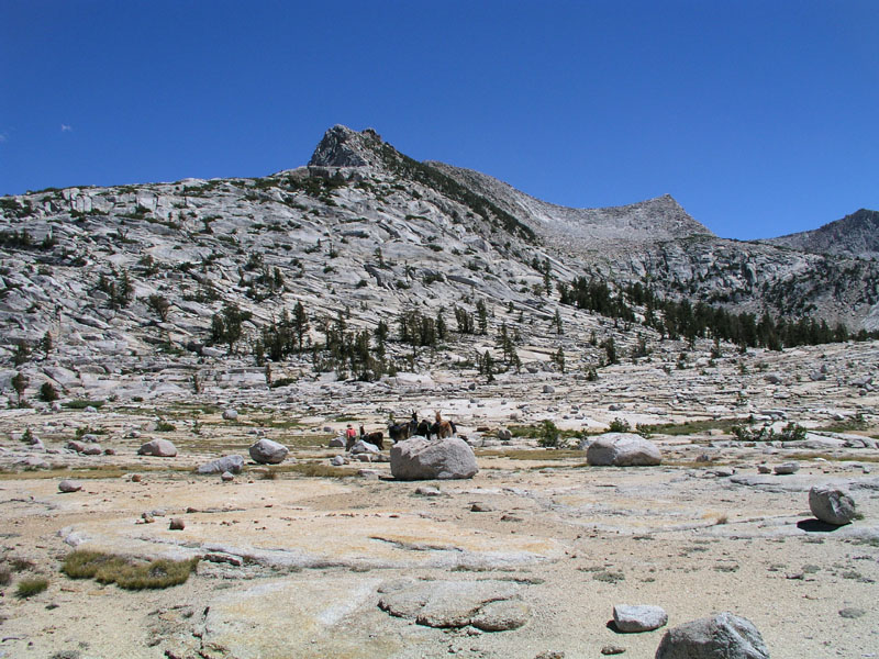
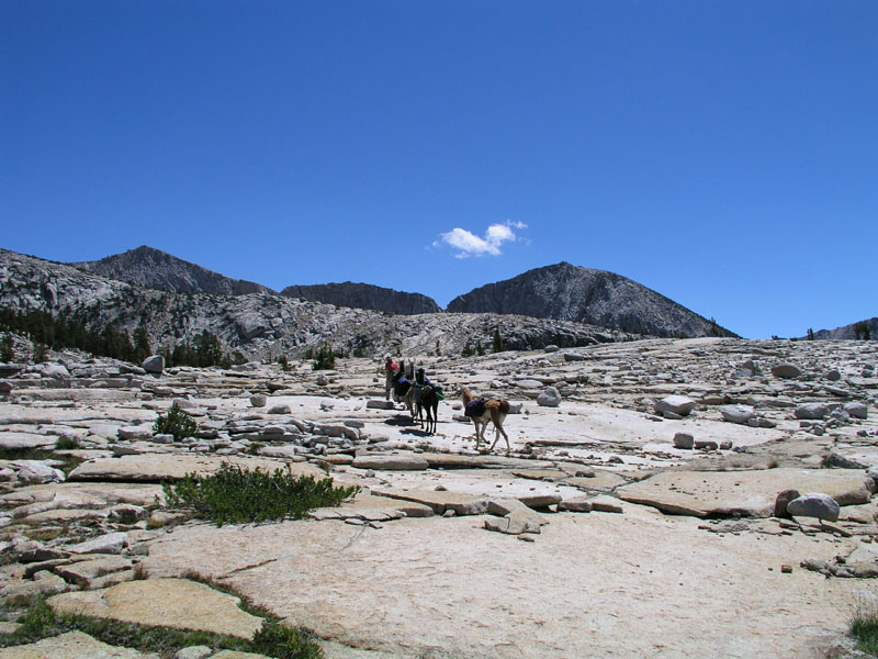
From the meadow, we walked up basin to the next meadow, this one being bigger and dryer. We stopped for a few minutes & photos then headed for the pass. The way up to the pass is steep and rugged. At the base of the steepest section, momma found an obsidian knife/blade scraper on the way up. My mom took pictures.
Daddieo taking video
Me holding all the llamas.
The scraper.
Other side of the scraper.
Great views were to be had all the way to the top of the pass. Momma took pictures and video while daddieo and myself continued up the mountain.
On top of the pass - panned out
Close-up of us on the top
Once on top, we had lunch and took lots more pictures. I hiked a few hundred feet further along the ridge until I was about 11240 feet. For those of you that know, I was higher than the top of mount hood and I still wasn't on top of anything! Yeah its fun being higher than the highest point in Oregon. The view from the pass looking into bench valley is amazing. I hope the pictures turn out!
The three of us having some lunch
Daddieo cutting up some salami
Do I smell a possible Christmas card?
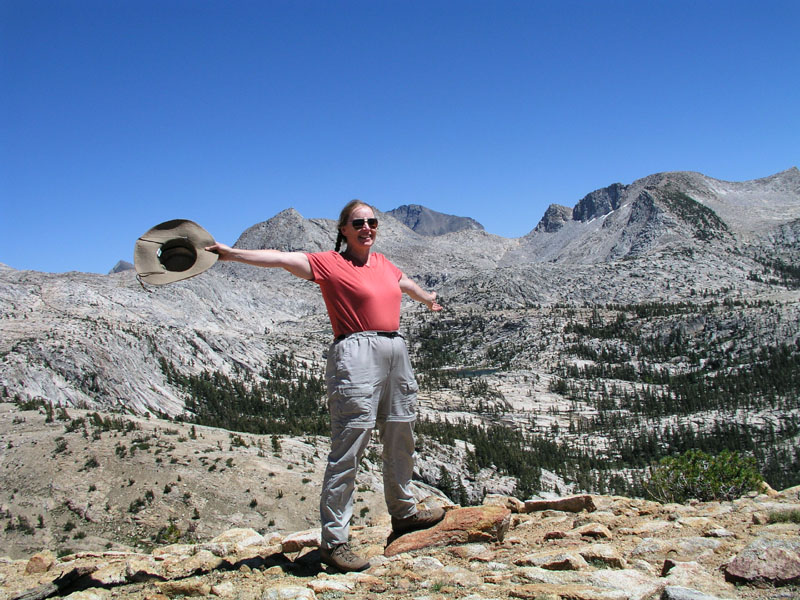
Momma proclaiming how much she loves this place

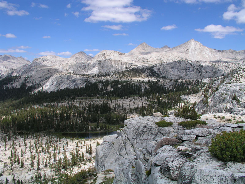
Panorama of the view from the pass. Scroll right to see the whole thing in all its glory.
Photos having been taken, we loaded up the llamas and started the short and super steep decent to the quartz pillow. The slope is at about a 70 degree angle. No joke! That in itself isn’t so bad, but being that the whole side of the mountain is composed of decomposed granite, it made for tricky going. Add to that very few hand holds & were we not so spry and nimble, disaster would have ensued. The pass dropped us right into the quartz pillow. We found a good spot to pitch our tent, picketed the llamas, and set the camp up.
Descending to the quartz pillow
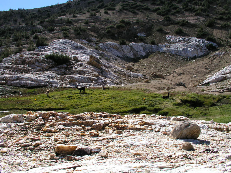
The quartz pillow covers about four acres of ground in total. All around, it is surrounded by normal granite but due to some geologic fluke, this big square chunk of earth is solid quartz! Through the middle of the conglomeration runs a little creek. It's very cold and clear. Throughout the pillow, there are veins containing clear or Ice Quartz. Native Americans used to gather it up and trade the material far and wide.
Llamas and Quartz
Looking toward the bottom of the pillow
Daddieo pumping water
I gather ice quartz too. I found many nice pieces to take home and use as I see fit. There are still a few pieces yet to find for those few extra special people. Among the many finds I made, several pieces stood out as excellent pendant candidates. Once back in Corvallis, I’ll look into getting them made into trinkets and baubles.
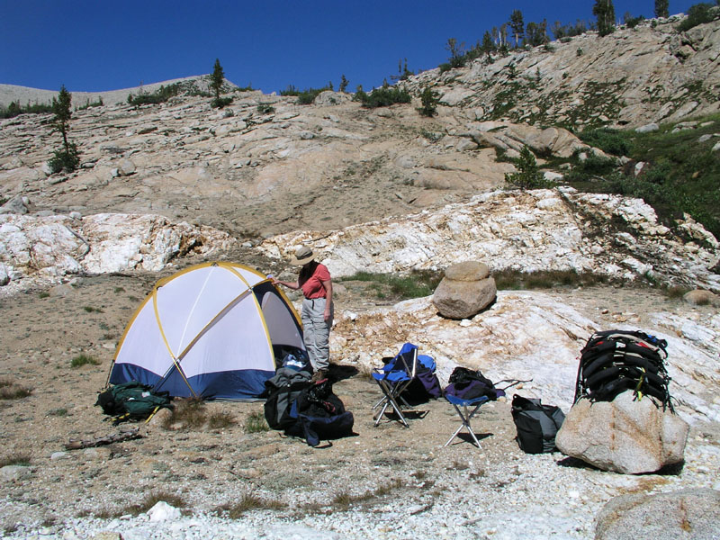
Our quartz camp
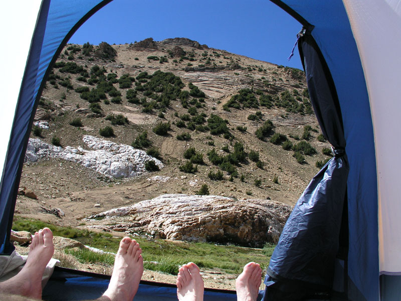
The view from the tent
The quartz meadow & llamas
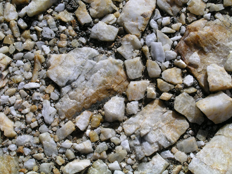
What one finds underfoot
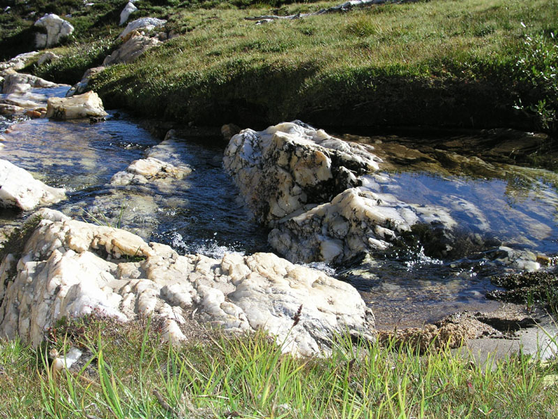
Quartz creek
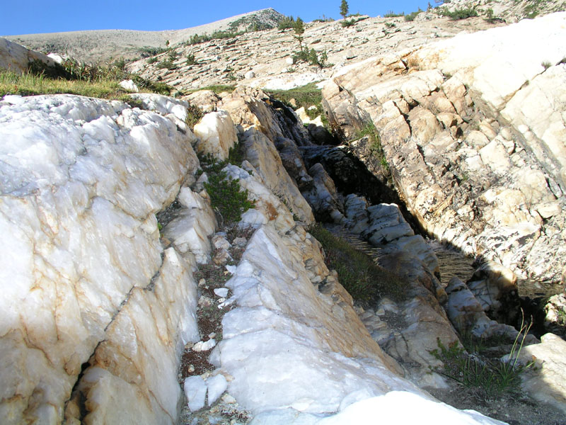
A fissure in the quartz
The llamas perspective of camp
Unfortunately, we won't have time to climb Mount Hutton this trip. Maybe next year. In fact we probably won't have a rest day at all! Tomorrow we head for Horse head lake.
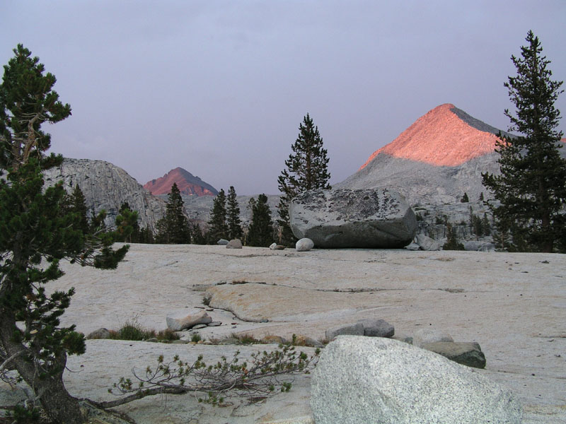
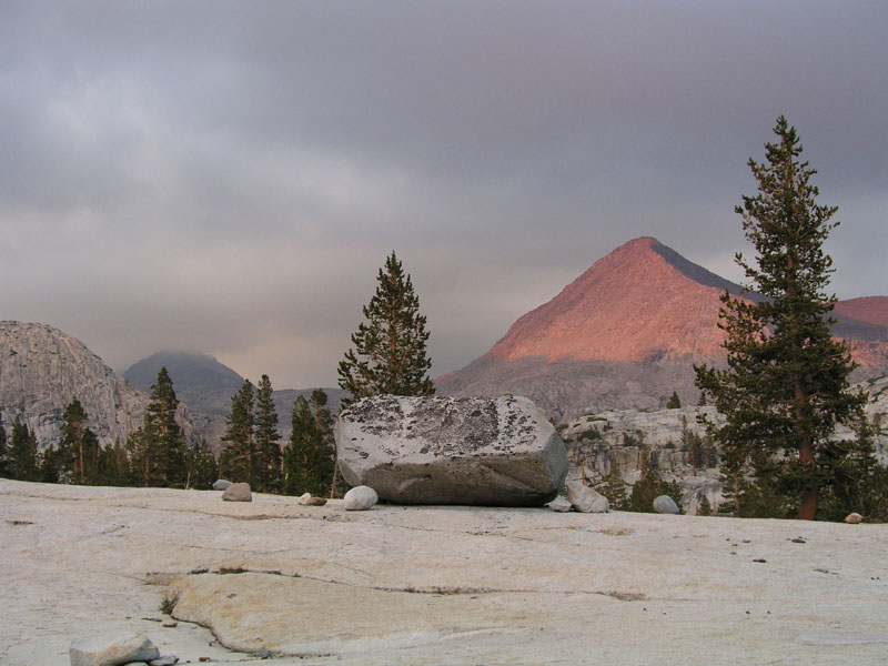
Nightfall on the quartz. Mount Hutton illuminated in the background.
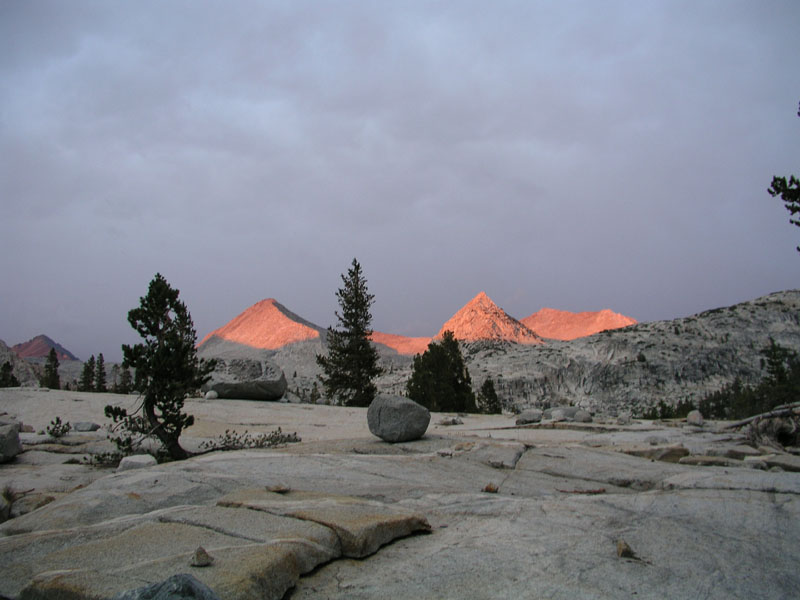
The view from the pillow is awesome. My mom took lots of pictures. We stayed out until about 9 to watch stars and such. The milky way was out in full force. At least two good shooting stars were seen. One day, I’d like to come out and get up on top of one of these mountains to really see the stars.
Illumination on mountains to the south
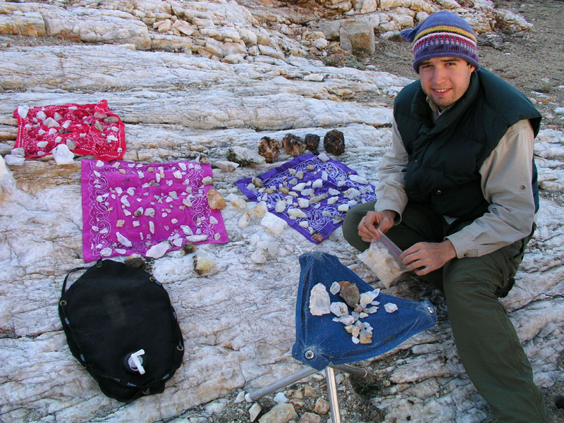
A small sample of the rocks that I carried out
Day Five
Camp Location: Mc Guire Lake
Altitude: 9950 Feet
Miles Hiked: 5.5
Well we didn't end up where we had planned. Originally, we were headed for Horse head Lake but we decided once we got to Horse head that we'd rather continue down the trail to Mc Guire lake.
We woke up to a very cold morning at the quartz pillow. I had to close my sleeping bag all the way up for the first half of the night to keep warm. The second half, after my parents woke me up as they got in and out of the tent for reasons best left unmentioned, I slept with my bag partially unzipped. Mars was bright enough that I could see it quite clearly through the tent walls. The previous night, we stayed up until about 9:15 to watch the stars. The milky way was out in full force, but of course I’ve said this all before.
Anyway we woke up to a cold morning without any sun. The sun didn't get above the bluffs until nearly 9am. I searched around the pillow some more for more clear pieces to take home. I ended up with about 15 lbs of rocks in my backpack. Daddieo has 5 lbs and the llamas are carrying another 10-20lbs. Hopefully out of all of those rocks there will be one or two extra special pieces.
The quartz pillow was departed at about 10am. It was a late start but we were finding lots of great rocks so it was worth it. Our party hiked up the creek from the pillow to the big alpine meadows. I took photos and daddieo took video.
Leaving the quartz pillow
Crossing the granite divide
Down the meadow
Looking back toward Mount Hutton
Daddieo taking video & getting left behind
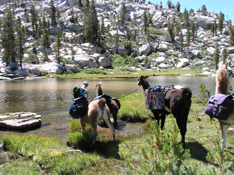
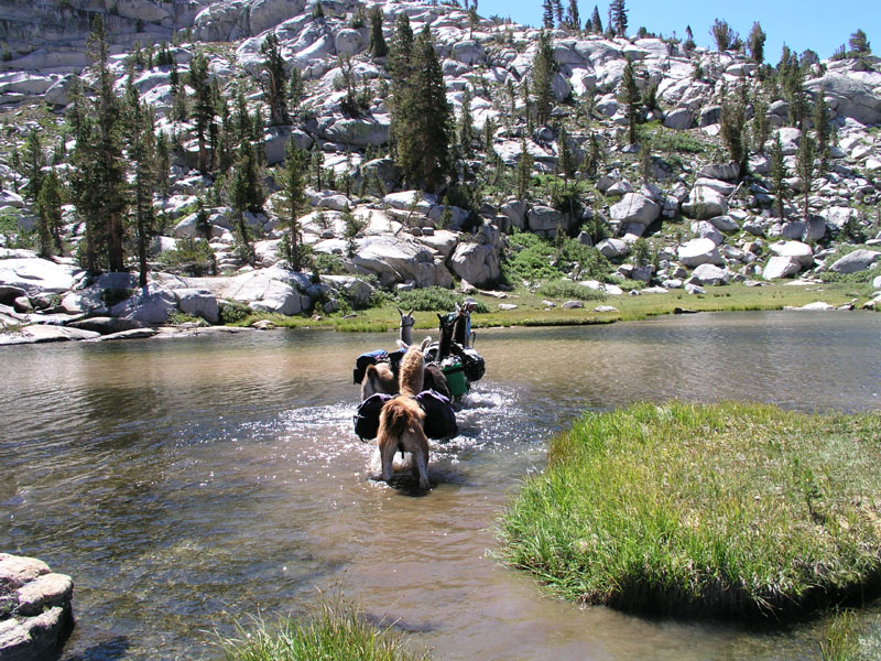
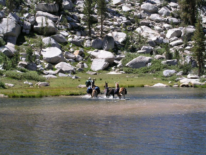
From the brook we struck out across yet more granite to Crabtree Lake. To get around the lake, the llamas have to go through the lake. All other routes require crossing dangerous broken slab granite rock. The string has done this crossing before without incident so we weren’t too concerned. Daddieo, leading all four llamas, went straight across the lake without a problem. On the other side, once he had put back on his pants, we climbed up a large crack in the rock to the next bench and a small meadow where we stopped for lunch.
The llamas are thinking "has he lost his marbles?!"
Into the water
All the way across!
Crabtree Lake
After the wonderful spread of food for both bi and quadrupeds, we loaded everyone up and headed out for horse head. The cross-country route took us past West Twin Buck. From there we struck out in the direction of Philly Lake across a vast expanse of granite and more granite. Somewhere along the way, we strayed a little to the right and ended up at Roman Four Lakes. Basically Roman Four is a huge swamp with four areas of more or less open water. Walking around the edge of the swamp, we stirred up a mess of bugs along with gobs of Yosemite toads.
Starting off across the granite
More granite
Even more granite
East Twin Buck Lake in the distance
A very photogenic rock
Starting down the hill to Roman Four Lakes
Horse head Lake. Panorama. Scroll right for the full meal deal.
Me on top of the boulder that the panorama was shot on
Boulder Camp at Horse head Lake
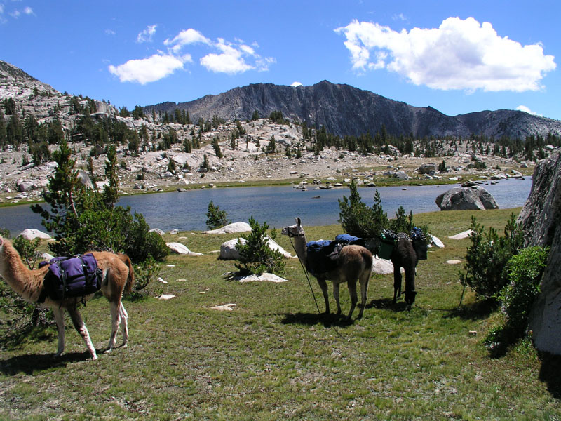
The llamas having a quick snack
Setting off from horse head, we went up and over a moraine and then dropped about 500 feet to Guest Lake. From Guest its just a short hike to Mc Guire. Daddieo found a nice spot to camp on the north shore of the lower portion of the lakes. I say lakes because the upper portion is about a half foot higher than the lower. A small moraine and some moss separate the two halves. There isn't much sky to be seen from here because we're down in a hole ringed on three sides by mountains and high granite bluffs. We are also back into the timber again meaning we can have a fire again! yay!
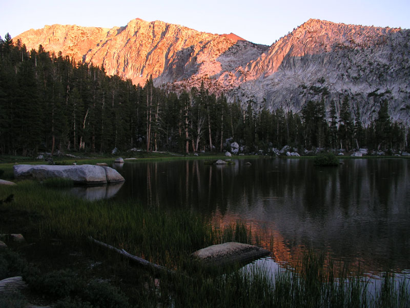
Mc Guire Lakes and Black Cap Mountain at sunset
I walked all the way around both lakes to scope out the terrain. No one had camped at the lake in over a year. On the south side of the lake, I found an overhang under a large boulder that had a good deal of very old charcoal and a bit of black on the ceiling. Obviously someone prior to Lewis and Clark had frequented this makeshift shelter. For water, we were forced to trek to the high end of the upper lake. Mc Guire is a very productive lake meaning lots and lots of microorganisms to clog the filter faster.
A productive lake means lots of fish!
Some video was taken of the lake as well as the normal digital pictures. It's night now and I’m about to have some lemon tea. Tomorrow we'll be in lightning meadow and hopefully we'll be there soon enough to get the solar shower out and get some showers.
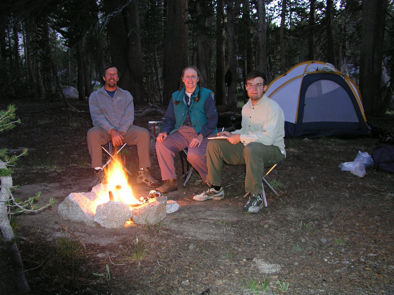
Sitting around the campfire
Day Six
Camp Location: Lightning Meadow
Altitude: 10275 Feet
Miles Hiked: 5
The normal sleeping in which I enjoy on these trips was dispensed with today. We woke up early to get a quick start and beat the heat crossing the vast expanses of slick rock. Mc Guire lake was left at about 830. Our group headed for the edge of the basin. At the rim, rather than descending on the official trail, a particularly poorly maintained chute of loose rock and soil, we took a hard left and picked our way along a narrow bench on the face of what amounts to a cliff with about 300 vertical feet of chances to fall.
Looking over the edge
The edge of the cliff. Looking north in the direction of courtright
Llamas doing the limbo
Mountain Meadow is a series of lush open meadows and thickly carpeted forest (carpeted with grass, the natural alternative to Astroturf!). There are several old hunting camps around the main open meadow and undoubtedly more hidden back in the trees.
The next leg of our voyage none of us had ever attempted before. On the topo maps, the route certainly looked feasible. From across the North Fork of the Kings, it looked probable, and from friends reports, it's doable. To be sure we stayed the course, I pulled out the GPS and my mom busted out her trusty surveying compass. We navigated down through grassy forests and wet meadows until our party hit a vast barren expanse of granite. The string headed straight across the blinding glairing granite toward the east. Momma and Daddieo both had sunglasses. The llamas and I were not so fortunate. After about a half mile of blinding reflected light, we got back into the forest. In this forest there were several beautiful cascading brooks which did their cascading off of the high granite bluffs above. Wandering through the forest, we found a long and narrow swale which was home to many a mighty red fir. My mommie and I walked down along the swale to see if we could find any old camps or other interesting things, but nothing of great importance was discovered.
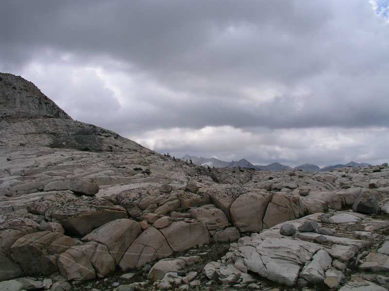
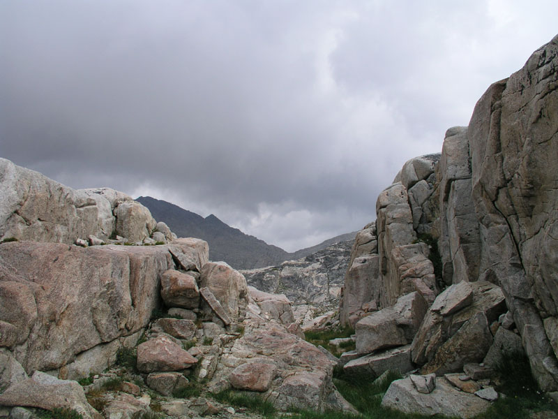
From the red fir grove, we headed northeast up through a half hearted forest mixed with short stretches of granite toward lightning meadow. After a spell, the terrain turned mostly to broken granite interspersed with the occasional stunted tree. It was starting to get hot and the clouds were proofing up a bit. The final accent into Blackcap Basin took us across many large fault lines and fissures in the rock. My mommie got some good pictures of us navigating through one of the obstacles. We went through a couple of very nice meadows and groves of trees tucked away from sight. Had we not gone up this route, we never would have seen or known about these wonderful places.
Our group finally pulled into lightning meadow around 1pm or so. Llamas and humans stopped at the bottom end of the meadow to have some lunch and take our loads off. Once finished with lunch, Daddieo and myself scouted around the lower meadow for a good place to camp. We decided to camp at our usual spot between the lower and upper meadows. Copious amounts of evidence of other groups of llamas camping in the same site were found. It appeared that just a few brief days before, four or five llamas had camped in the same spot! The blame for this rests solely upon my mom's shoulders as she published an article several years back detailing a trip in which we camped in this very spot.
Loads were put back on the llamas and we headed across to the campsite from our lunch spot. The llamas at first thought we were going to keep walking! they sure were happy when we stopped only after a few minutes of walking. After unpacking the gear, the quadrupeds and bipeds settled into a relaxing afternoon. Momma and daddieo went into a little pond created by the creek backing up between the two meadows. I sprawled out in the tent and worked on my tan. The fabric of the tent is very much NOT UV protective.
At about 3:30pm, my sun suddenly went away. I poked my head out of the tent and looked up to see a band of dark clouds advancing west and north. Tropical moisture to be sure! remembering the last batch of tropical moisture, we put the fly on the tent and battened down the hatches. I stripped down to my skivvies and went up to just above my belly button in the water to clean up a bit. Due to the sun's absence I couldn't bring myself to go all the way. Without some rays, 10000+ feet gets mighty cold!
Pink mountains! so colorful!
Goddard Mountain on the left all lit up
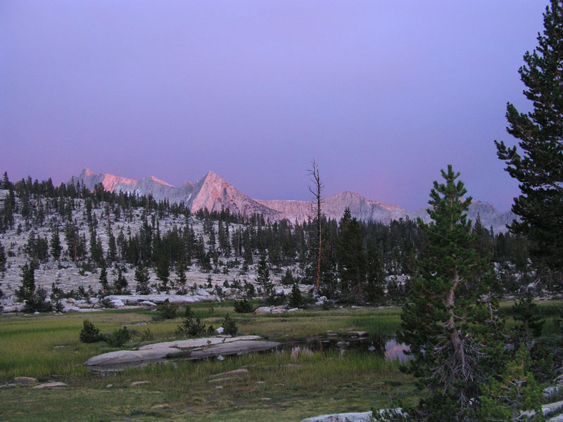
Mountains to the south
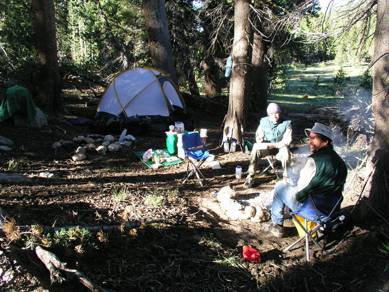
Camp & dad
Day Seven
Camp Location: Lightning Meadow
Altitude: 10275 Feet
Miles Hiked: 3 or 4
We woke up to a cloudy and rainy sky this morning. The decision was made this morning that we really need a rest day for humans and llamas alike. Actually, we've decided to spend three nights here.
Last night the sky was ablaze with lightning but devoid of thunder. Daddieo says it was a lot like head lightning back in New Jersey when he was a kid. The rain came in bands today at about half an hour intervals. Finally, around 11am the clouds broke up some and we went on a walk around the lower and upper meadows. I found a nearly perfect arrowhead laying in a gully. Photos were taken.
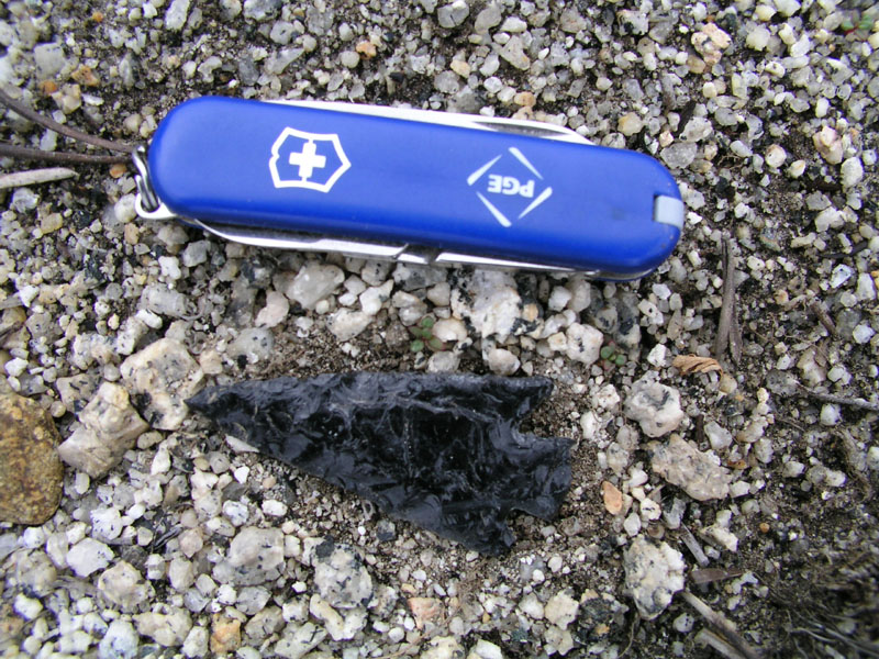
Arrow head & mini pocket knife for perspective
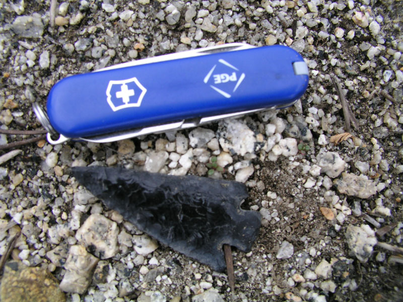
Other side of the arrow head
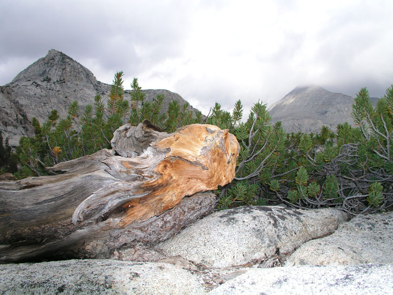
Post lunch, my daddie and I went on an expedition up to Rainbow Lake. Rainbow lake is very desolate. Zero vegetation. Just cold hard rock. The rock is actually rather interesting as there are many odd intrusions of different origins in the granite. Just on the other side of Confusion pass (above rainbow lake a spell), the rock changes from granite to metamorphic. I picked up several nice samples.
Rainbow Lake
the cinematographer is caught on digital film & vice versa
Looking toward Confusion Lake and Confusion Pass
Dark clouds and dark rock
A large fault line which was also our makeshift decent route from Rainbow Lake
The mid-basin above Lightning Meadow and below Rainbow Lake
Southeast toward Pearl, Chappell, Cathedral, Division, Battalion, and many other great lakes
Blackcap mountain
Dead and live trees with a backdrop of clouds and mountains

Black tree on blue and white sky
Does this remind anyone else of a late 18th century French painting?
An old Sheppard’s camp in the mid-basin
Time to go watch the stars. Tomorrow we're going to day hike to Crown Basin and prepare for the three day trek out. Off to look at the stars!
Day Eight
Camp Location: Lightning Meadow
Altitude: 10275 Feet
Miles Hiked: 8 and a little bit more
Today was yet again another rest day. I got out of the tent at around 8am. There wasn’t a good reason to be up before then. We ate some granola and put the llamas out in the meadow for the day. Last night we decided to go on a day hike to midway lake. shortly after breakfast we stet off across the granite. I was volunteered to carry the backpack first. From camp, we proceeded east up a ridge to Division Lake. The lake is fairly barren, as with most of these lakes above 10500 feet. Our group hurried on across another ridge to Pearl Lake. The lake has an isthmus that reaches out from one side and nearly touches the other. Some thoughtful hippie back in the 70's laid rocks across the short shallows to allow for rock hopping. This we did and then onward to yet another ridge and Chappell Lake.
Panoram of Upper Blackcap Basin - Scroll over for full effect
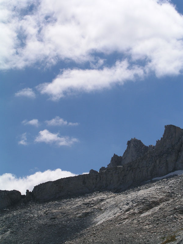
Crags above Cathedral Lake. The notch on the left is a pass that I’ve hiked up to & peered over.
The good doctor just above Midway Lake
Me and my mommie
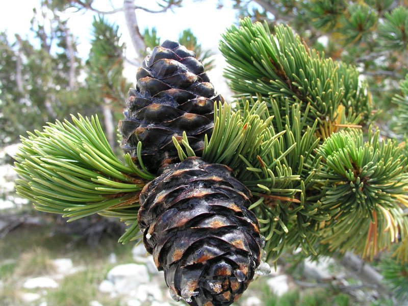
Close-up of some pinecones
Portal Lake over the edge of the cliff
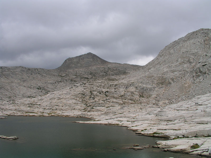
Momma and daddieo were surprised to discover fish in Chappell Lake because just a few years before the only inhabitants had been frogs and toads. Now all the amphibians have been eaten and replaced by a rainbow/golden trout cross. From Chappell, we went up over a little rise and down to Midway Lake. Daddieo pumped water while momma and I filmed and photographed the area. After meeting back up with daddieo, we hiked over to the divide between Blackcap and Crown Basins. The three of us walked along the divide to a point that drops off about 200-300 feet on two sides. Lunch was had with a stellar view of the entirety of Blackcap Basin and most of Crown Basin as well as the North Fork of the Kings river.
Panoram of Blackcap and Crown Basins - Scroll over for full effect
Daddieo Videoing
Portal Lake and Blackcap Mountain
Looking toward Division, Pearl, and many other lakes
I am one with the world
This could be a Christmas card
Pearl Lake
We arrived back at camp at 3:30. I lounged in the tent for a while and then got my journal out and wrote a bit. Now it's dinner time.
Now I’m sitting here drinking my tea and waiting for mars to come up. Tonight is the closest it will come in 65000 years so it's a momentous occasion. Tomorrow we break camp and start the long trek out. We're more than 20 miles from the nearest road. It will take us three days to go that distance with the llamas and my mom. Her knees have been giving her lots of problems. Downhill causes just about anyone pain though, especially 20 miles worth. Mars is up. time for the nightly show that is the heavens.
Goddard capped with clouds and Little John lit up
Last rays of light in a bright and cloudy sky
Day Ten
Camp Location: Flemming Creek at North Fork of the Kings (next to a juniper tree)
Altitude: 8074 Feet
Miles Hiked: 10 or 11
I woke up around 6am this morning but laid in the tent and soon fell back asleep. My mom had not yet exited the building. Around 7am, my parents persuaded me to wake up, come outside, and help catch granite. He had escaped from his picket and was having a grand old time running all over hill and dale. Granite was finally corralled by bringing all the other llamas in close to camp and using the picket ropes as a makeshift fence. Granite's big adventure was over and it was time for breakfast. bread on a stick and dried fruit made up the bulk of the meal. Thanks in part to granite's escapades, we weren't able to leave camp until 10am.
From camp, we headed across the meadow and down the rocks toward the North Fork of the Kings. Right after we crossed the river, we saw two backpackers playing in a big hole. They were the first people we had seen at under two miles since Flemming Lake. We waved and they waved back but neither party spoke. If you're counting, that's something like seven or eight days not seeing a soul. Try that in a city!
Crossing the North Fork of the Kings River just below Black Cap Basin
The trail down the North Fork meandered through a couple of miles of avalanche zone intermixed with big trees. IN the avalanche tracks, the ground was covered with flowers and other pretty things amid the destruction and carnage. Our group pulled into Big Maxon Meadow at about 1pm and had lunch. That was mile seven. After lunch and a bit of a rest, everyone loaded back up and headed down the trail toward the 8000 foot level and Flemming Creek.
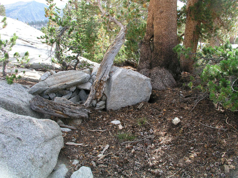
We've made our camp right on the bank of the river next to an ancient and huge juniper tree. I took many pictures to try and capture the grandeur of the tree. Some poor fool lost his or her rope and rope bag up in one of the lowest branches of the juniper tree. By lowest branches, I mean 20-30 feet up. Undoubtedly, the rope losers were trying to hang their food in case an animal wanted to eat it. That way it'll be food on a rope! On the way down from Big Maxon Meadow, we saw monster bear prints that daddieo says easily could be from a 400 lb bear. Mighty big bear!
Juniper Camp
Another, much smaller juniper tree
Daddieo cutting grass across the river for the llamas
Our camp under the juniper tree
The riverbank
I'm afraid we won't be seeing mars quite as early as last night. Down in this canyon we only have an open view from 45 to 90 degrees in any direction. I'll still be on the lookout though, just in case mars decides to surprise us. Tomorrow we are going to try and hike all the way out. It's nine miles from here to the trail head. The deciding factor will be my mom's knees. Luckily all but the last two miles are uphill, which her knees like the most. Seeing as how I’m now on page 69 in my notebook, I’ll be starting volume II tomorrow. There's deer or other such animals moving around out in the bushes. They might make for an exciting night!
Mars is rising. Through some miracle, we can see mars fairly early in this deep canyon. Tomorrow is the end of our voyage. It will be back to civilization for me. 60 HZ hum, computers, phones, internet, work, all things that are great but at the same time horrible. Newberg also awaits me outside of this, my mountain retreat. Well enough of what is good and bad in the world outside the mountains, it's time for some high quality sleep.
Day Eleven
Camp Location: Fresno
Altitude: so low it makes my head hurt
Miles Hiked: 9
Today was the last day for us to be in the mountains. We got up fairly early so as to make it out of the canyon before the sun starts baking the exposed granite rocks which the trail winds over. Nothing too eventful happened last night once I went to bed. I had some interesting and disturbing dreams of what was waiting for me in Newberg. I should have just stayed in the mountains.
.jpg)
Leaving Juniper Camp
Hiking down the last little bit of the North Fork before the trail turned north toward Post Corral, we passed several enclaves of people who had camped near the river for maximum fun. They looked at us and we looked at them. Nothing was said. About a mile out from post corral, we passed the camp of the same two hikers that we had run into coming out of blackcap basin. We talked with them a little bit and then moved on. It was 11am and they were just waking up. College students or professional computer programmers to be sure.
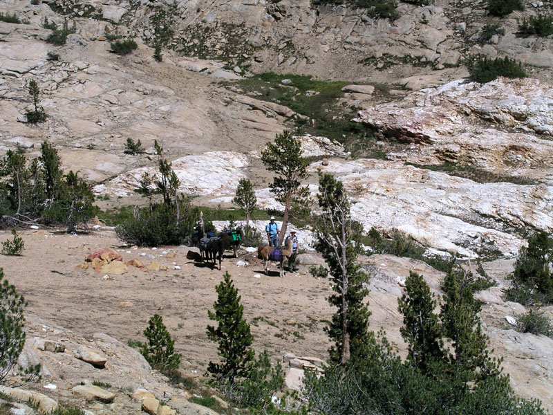
Nothing much had changed at post corral since we last had been there 10 days before. Of course, not much changes up here from year to year. A half mile past post corral, we ran into Dr. Clyde leading in a horse and mule pack string. The pack concession for this part of the world is owned by Dr. Clyde. He used to be a practicing doctor and still might be in the winter, but during the summer months Dr. Clyde runs pack strings up in the mountains. Dr. Clyde and my parents talked for a while about various things before both groups continued on their separate ways.
Once again, as we passed our normal camp in Long Meadow, the llamas were very disturbed by us not pulling off for the night. Daddieo practically had to drag Magma to keep him from going over to the camp on his own accord! Chaco, whom I was leading, doesn't know the camp, so I didn't have any problems. At the head end of Long Meadow, we stopped in the same place as we had for lunch on the first day in. The llamas were watered and staked out in the meadow while we had some food ourselves. The two backpackers whom we had seen at the top end of the North Fork and just before Post Corral hiked by while we lay in the grass and gazed up into the sky.
The grade up chamberlain’s hill was surmounted in record time as it had just dawned on the llamas that we were hiking out. At the creek crossing about two miles from the trailhead, a new sign had been nailed up. I got a very dorky picture of me standing next to it. The trailhead was finally reached and truck spotted. We unloaded and watered the llamas then the woolen mammals and those of us with hair had our separate snacks. On the way down from the mountains, we stopped a few times so I could collect some nice piece of granite to be used in a bubbler fountain at a later date.
.jpg)
A new wilderness regulation
And with that ends the account of my summer vacation. It may be poorly written, have words misspelled, and contain grammar of the sort that only grade-schoolers could get away with but it's my hope that this gives you, the reader, more of an understanding of what shapes my mind, body, and soul. well actually the soul thing is up for debate... But anyway, this is what I’ve grown up doing. Its what I love. I am a part of the mountains and they are a part of me.
Copyright 2004
Welcome to the very bottom of the page! All material on this site, including but not limited to, text, images, and site layout and design, is copyright. Copyright © 1983-2012, Spring Creek Llama Ranch. All rights reserved. Nothing may be reproduced in part or full from this site without explicit written permission from Spring Creek Llama Ranch. All website related questions can be directed to the webmaster or webmistress. Questions about llamas, services, or other such things, can be directed to Spring Creek Llama Ranch.
Day One
Camp Location: Post Corral Meadow
Altitude: 8300 Feet
Miles Hiked: 6.5
Finally! After three days of delays due to break problems with the truck, we made it to the mountains. The big red trailer pulled by the big white truck with brand new front rotors pulled out of my grandparents house at just after 8am. Two hours later, we arrived at the ranger station just outside of Prather. My parents went inside to pick up the wilderness permit. I waited with the rig, llamas, and gear.
A fire crew pulled up in an old beat-up school bus. The bus was full of city boys leading the easy life. One came over to talk to me and look at the llamas. He had hair jell and even aftershave! These boys clearly hadn't seen much action.
Once my parents came back, we piled into the truck and started up the new tollhouse grade. The very same grade that my great grandpa had helped build. As can be expected during the summer months in the central valley of California, it was HOT. 10am and we were already pushing 100 degrees. When we drove past the gas station at the top of the new tollhouse grade, the air temperature literally dropped 20 degrees. Windows were rolled down and arms extended in a very cowboyesque manner.
As usual, our truck was the tallest thing on the road. What gives with all these low-riders??
We barreled straight through Shaver Lake. No stops necessary. Our next port of call was Dinkey Creek Ranger Station where we stopped to fill up our MSR water bag. Nothing much had changed since the last time I laid eyes on the place in the summer time, about three years ago.
Following the water stop, we drove onward and upward through Mc Kinley Grove (where thar be redwoods) to the fork in the road where the avid outdoorsman chooses either to head for courtright reservoir (as I said, I cant spell) or wishawn reservoir. We chose the courtright road.
Courtright lake was about 20 feet down from full. Not too bad considering it was the middle of august. One of my great grandpas helped build this too. (that's great grandpa Douglas as I understand it). We drove over the top of the dam on the narrow one lane access road & around the side of a granite dome to the trailhead. There were 14 cars and one truck (ours). No other stock. When my parents used to be wilderness rangers in this area in the 70's, most days saw at least 70 cars. Some of this drop-off can be attributed to California’s schools starting a few days previous to our arrival but in California, unlike Oregon, outdoor recreation has dropped off in recent years.
Some lunch was had at the truck, llamas were loaded as well as humans, and we hit the trail at high noon. Our group hit Chamberlain’s Camp in an hour flat. From the trailhead to chamberlain’s it's about 2 miles or maybe a little more. There was a brief stop at the bottom of Chamberlain’s hill & then we headed up the hill. In under 30 minutes we were on top and started down the other side. That's really good considering the top of the hill is at 9000 feet and the bottom is at 8500 or so. Elevation DOES make a difference. The weather was a bit cloudy with some darker thunderheads building back toward Evolution Valley in Kings Canyon National Park.
We stopped for a sit down - load off break at the top end of long meadow. The llamas were very happy to have lots of succulent green high altitude meadow grass & pine trees in great abundance. Slim pickings were had over the previous days in Fresno.
The break lasted about 20 minutes then back on with the loads and down the trail to Post Corral. Since our truck had been kaput for several days & thus we had been delayed in starting our trip, we were headed to post corral, rather than our original plan of red rock basin. The original trip had called for an extra two basins. Now we were planning for a little more compacted trip.
We pulled into our usual campsite at 4:15. Total distance hiked was around 6.5 miles. Not too shabby considering I was carrying just shy of 38 lbs in my backpack at more than 8000 feet without any time for acclimation!
Post Corral is nearly the lowest point on our trip. We'll hit right on 8000 feet coming out of the North Fork of the Kings river but this is the lowest camp we have planned. Tomorrow we head for Devils Punch Bowl Lake in Red Mountain Basin & maybe even as far as Meadow Brook.
Coming into post corral meadow, we got rained on for about 20 minutes. Not enough to make us put on rain gear but enough to keep the dust down which is good because I was behind the string of llamas leading our youngest and most inexperienced llama, Chaco. He should have been going first, for training purposes, but he had decided that he would rather be rear guard. We also heard 10 or 15 good rolls of thunder. Some sounded cloud to cloud and some sounded cloud to ground. This is the first time in several years we've had any weather to speak of. I hope we get some more exciting weather! well as long as most of the days are sunny so I can work on my tan. LOL.
For dinner, I had some sort of noodle & chicken freeze dried mountain house meal. It was fair to okay. As I sit here in camp, I can see a piece of white nylon rope stuck on a branch in a tree a little piece away. Someone's piss poor attempt to hang their food so that bears wouldn't bother it. We are just going to put all the food into the vestibule along with the rest of our gear for the night. If a bear comes around, the llamas will let us know far in advance of any camp incursions.
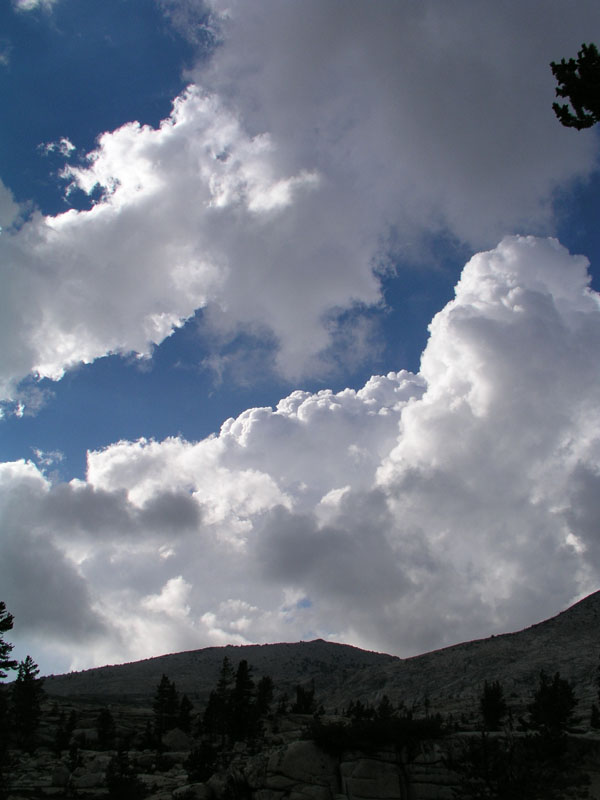
The clouds have now pretty much broken up & promises of a good sunset are being made. I shall have to get the camera out and take some photos. A clark's nutcracker just flew over making the typical racket that they do. West Nile Virus will wipe them out once it reaches here. They may be pesky at times but the woods will be a whole lot lonelier without them. Speaking of quiet, I forgot how nice it is up here. No cars to make noise, no people to chatter endlessly, only one or two jets now and then but even then, only for a few seconds. The best thing above all is that there is no 60 HZ hum! NONE! As far as I am concerned, AC electricity is the plague of our modern society. Never are we without the comforting, yet hollow hum of the power grid. Well at least not in the low country.
The sun set isn't turning out that great tonight. I'll take a few pictures just the same.
Day Two
Camp Location: Flemming Meadow
Altitude: 9790 Feet
Miles Hiked: 6.5
Today was a very exciting weather day! I woke up somewhere around 630am & got out of the tent. There were already clouds! The clouds weren’t thick but covered a good portion of the sky. For breakfast, I had some granola & tea. Much to my dismay, I discovered that our tea selection is rather lacking. Due to this fact, I just stuck with some mint tea. It was good, but I really am missing the much larger selection of teas that I have to choose from at home.
We tore down camp and got underway by 9:15. There were already several thunder clouds building by courtright and burnt corral. We headed up the trail for Red Mountain Basin. Just before the blasted rock section of the trail up out of post corral, our train stopped so that daddieo (my dad) could fill up the MSR bag with water from a hidden spring. Some years when post corral is overflowing it's banks, we hike up to the blasted rock and camp by the spring. Today though, we just got water.
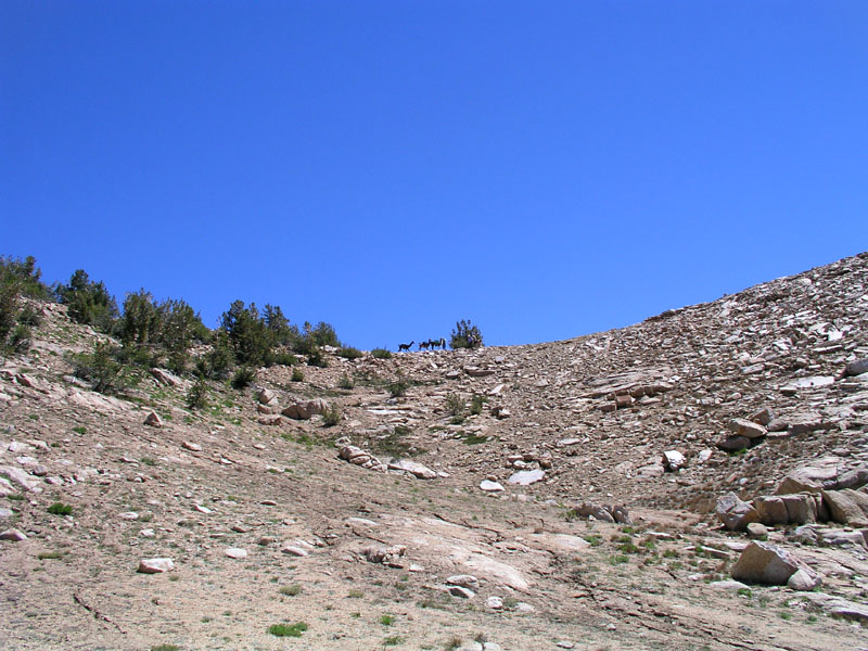
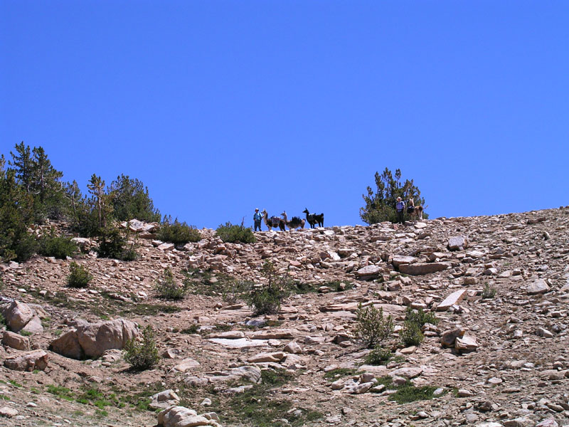
Momma (my mom) got out the video and digital cameras and took some photage of us crossing the blasted granite. Climbing from Post Corral to the top of the pass is a total of about 1400 feet of elevation gain in about 2 miles. 3/4 of the way up, we met a family from Munchen. They had been backpacking up in Red Mountain Basin for a few days while on holiday in America. The family had never seen llamas before. Thusly, pictures were taken and llamas were petted.
By now the clouds were building pretty good and had ominous looks in their dark underbellies.
A spell further on, we ran into a guy, his son, and his son's son coming down the trail. They had also (also had?) been up in the basin.
We got to the top of the pass in one hour 45 minutes. I went to the edge and took some pictures while momma and daddieo got out some snacky snacks & liquid refreshment of the type common on camping excursions. (IE water & Gatorade). It was yummy.
Post-snack and water break, our merry party of llamas and humans struck out once again toward the cutoff for Devil's Punchbowl. By this point, the clouds looked rather angry. We even felt a few drops of rain. Prudence took the upper hand and we decided make for Flemming Lake instead of the punchbowl. Devils Punch Bowl sits in an exposed location at the lip of a substantial drop off. To get to it via the cutoff, one has to cross great expanses of exposed granite. Not a happy place to be in a storm!
The string pulled into Fleming Lake right at lunchtime. We ambled on over toward our normal campsite only to run into a very queer individual. He looked about 60-70 years old and was wearing a bright orange down coat. He asked us where we had come from and said "you couldn’t have come from there!(post corral) We came from post corral and the trail goes over there (points in a different direction)" Anyway he was very strange & in our campsite! The decision was made to head around the lake a little farther and stop for some lunch. The odd fellow followed us over & talked to us with long awkward pauses in the conversation. Pauses created by us trying to give him the hint to leave.
Once finished with food, we loaded up again and told the odd orange guy that our group was headed for Dale Lake. About 1/4 to 1/2 of a mile farther up the trail in Flemming Meadow, we decided the sky looked down right pissed off & pulled off the trail in an old campsite which we had last visited in 1986. The tent was hurriedly erected & the fly was thrown on. Hatches were battened as the sky looked ready to storm. A few drops fell but not much, so we got back out of the tent & lay in the sun. I felt dehydrated so I ate about a table spoon of salt and drank a quart of water.
The sucker-hole in the clouds moved on to the north and it began to get dark. I got in the tent and promptly fell asleep (due to the dehydration). About an hour later, I awoke to the sound of pounding rain. It had started raining quite hard right after I fell asleep. I still felt a bit woozy, most likely altitude sickness, this being the highest I had been in several years.
At the front of the tent where the vestibule is, there was a lake of water. Our bags were getting wet! Luckily everything is double bagged with garbage bags just in case something like this occurs. Daddieo put on great amounts of water repelling clothing and got out of the tent into the storm to dig trenches to aid in draining of the lake. I took some photos and some video.
Lightning and thunder started cracking all around the basin as the rain picked up its pace still further. The ground couldn’t absorb the water fast enough. Everywhere I looked, there was an inch or more of water running along the ground. After a while, once more moats and canals were dug, daddieo got back in, now very wet even in spite of the rain gear.
We sat in the tent another hour or so listening to the thunder and counting seconds between flash & crash. The closest we counted struck just under a mile away. From what we heard, Dale Lake and Devils Punchbowl were both getting pounded with rain and lightning. At about 5, I got fed up with the tent and got out into the rain. After so much moisture, the levies & dikes needed reinforcement. The tent fly also needed to be tightened. All of the llamas were rather bedraggled looking. The resembled drowned rats or poodles that had gotten left out when the sprinklers turned on.
Finally the rain let up at about 6pm. Momma and daddieo got out and made some hot water for dinner. I had stroganoff or some reasonable facsimile. Freeze dried of course. The clouds continued to look ominous and grumbled at length with cloud to cloud lightning until about 730pm when things started breaking up. I got out the camera and took some nice sky shots and whatnot.
It's dark now. There are a few patches of stars in an otherwise inky black sky. This would be a great place to watch the stars, save for these clouds which are trucking on through headed to Oregon. The whole lot of clouds is going south to north, keeping us guessing as to what might be coming next.
Tomorrow we will try and make it to meadow brook before things get nasty. This extra day wasn't planned so our trip shall adjust as necessary. Possibly we'll skip crown basin or stay only one night in Black Cap Basin. In two days we'll be at the quartz pillow. Hopefully I'll be able to climb Mount Hutton (12001 feet). At the quarts pillow I’ll also search for some good pieces of clear quartz to give as gifts. It's very dark now. Time for some sleep.
Day Three
Camp Location: Second Meadow Down Meadow Brook Trail
Altitude: 9840 Feet
Miles Hiked: About 5
We woke up to a clear sky. The rain of the previous day had pushed the smog layer far down into the valley providing us with a deep blue dome over our heads. Of course everything was soaked from several inches of rain. I went over to the creek to take some pictures of how beautiful everything was only to discover that all of the pictures we had taken up to this point had mysteriously vanished! about the only thing I can think of is that the electrical storm freaked the camera out and made it wipe the compact flash card. this is why there are no photos up to this point.
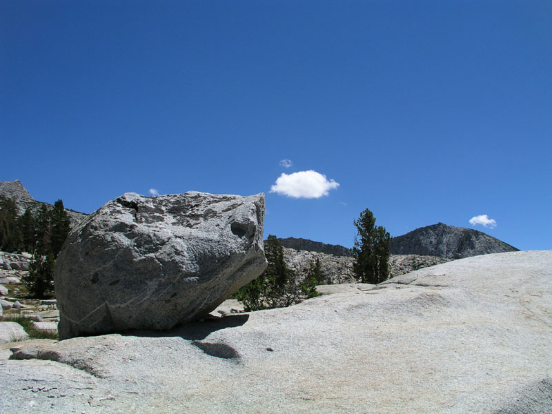
Deep blue sky
We dried out what we could and loaded everything up. Camp was left at 10:15 or maybe a shade before. The trail toward Hell For Sure Pass winds up over the first ridgeline on the way to Hell For Sure Lake. We went up to the first bench, non-stop, in just under 30 minutes. A new record for humans and llamas alike! The llamas decided we needed a break just over the top of that first ridge in a big open space. I proceeded to take copious photage of the place. Had we not lost all those pictures from the first two days, we would be pushing 100 photos in 3 days time. God I love digital photography!
Taking a break on the ridge
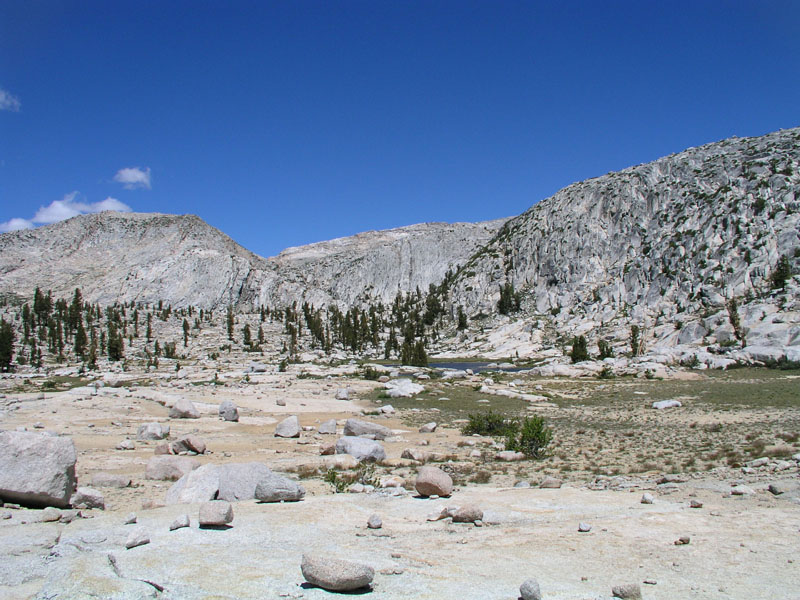
Panorama of Upper Red Mountain Basin. (scroll to the right for full panorama)
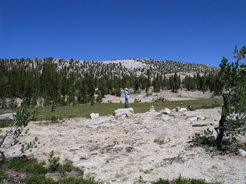
Me
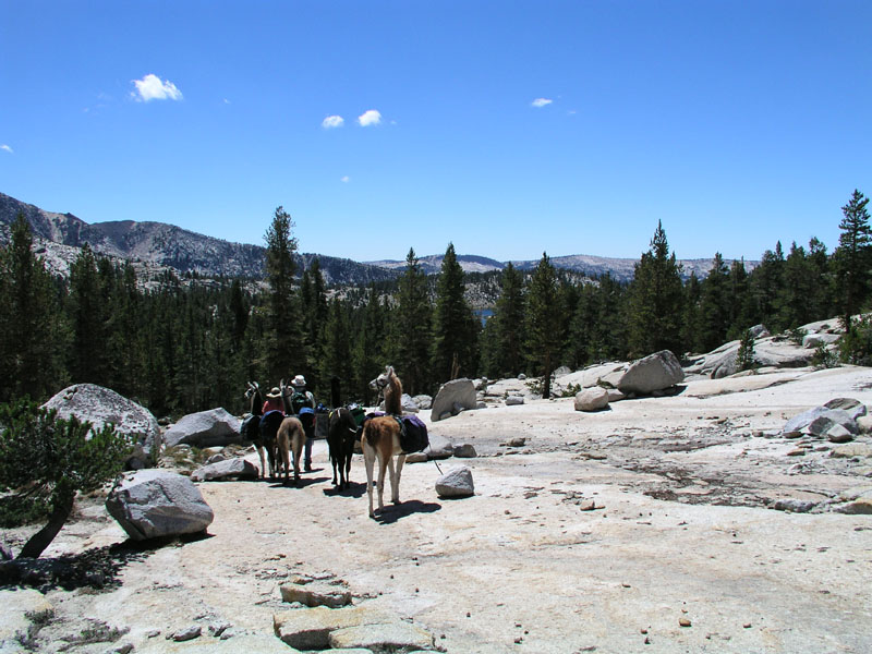
Heading across some bare granite
On the trail to Disappointment
Disappointment Lake
Crossing the outlet at the bottom of Disappointment
We ate our lunch up above the llamas on one of the many granite outcroppings to provide a better view which as we all know, aids in digestion. I got the camera and tripod out and did some photographic work. My dad got the video camera out and we did a bit of that too. After food and photos, we loaded up and headed on around the ridgeline/precipice edge angling toward bigshot and little shot lakes. Crashing through the brush on this cross-country route, our party managed to startle several does and their fawns.
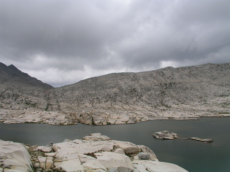
Evidence of the previous day's storm was everywhere. In many places there were banks of hail several inches deep under a layer of pine needles that had been washed down the rocks. Once on top of the ridgeline to the north of the punchbowl, a nice view of the surrounding country through a loose stand of pines was had. Down the ridgeline we went toward the lake. It was very windy. Very pretty. Photos were taken on the way down in multiple mediums. A brief stop at the Punchbowl was made for more pictures and such in every format imaginable, then back on the trail once again, toward Meadowbrook.
The trail from the punchbowl over the ridgeline and into Meadowbrook is pretty sketchy. Luckily there were whole flocks of rock ducks to mark any number of trail routes that we could take. The llamas smelled the sweet grass of Meadowbrook ahead & started pushing on us to go faster. We came down to the second meadow from the top & pulled into a camping site which we had used on a previous occasion.
A tree had fallen across our normal tent spot so we were forced to make a new home for the tent. Daddieo got out the saw and hacked up a good portion of the top of the tree to make it easier for us to go and come from the meadow. We found some fresh bear droppings near the camp. It appears there's a resident bear in these meadows.
Due to the previous night's soaking, all of our bags had to be emptied and everything was laid out to dry. We lost some Pepto-Bismol and some paper boxes but otherwise the plastic bags saved the day. While stuff dried out, I went and got wet down in the creek that runs through the meadow. It felt good to give myself a bit of a bath. Afterwards, I sprawled out in the grass with just my boxers made into a very grotesque thong-like apparition to get some sun. I want to make sure I’m looking good when I get back to Newberg! My arms and face are already quite tan after only a few days so I figured that it was time to give some color to the rest of my body.
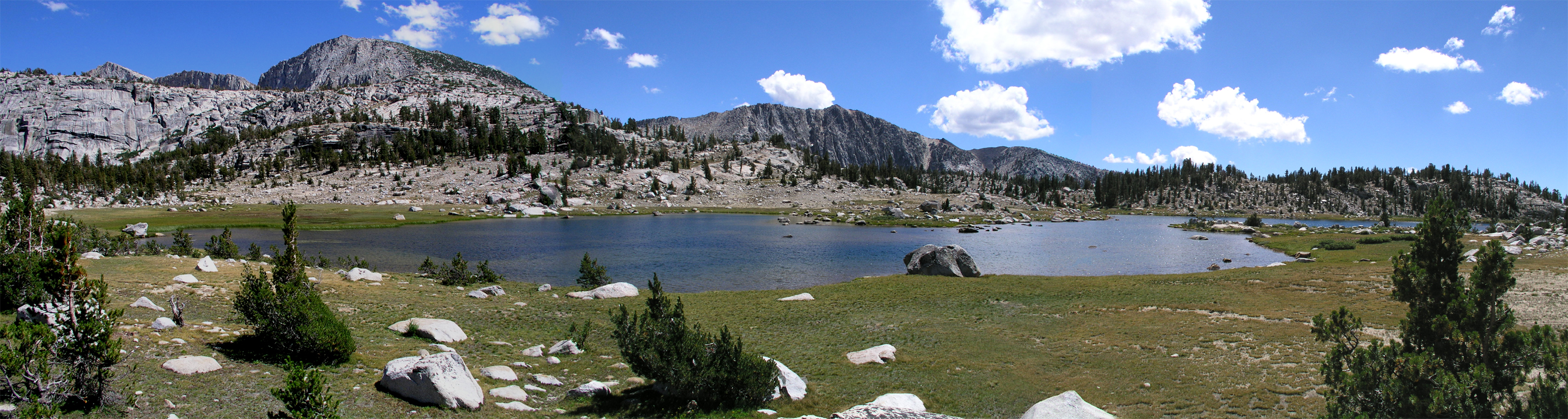
Meadow Brook Panorama
Meadow Brook Camp
Me, my cap, and my writing
Day Four
Camp Location: Quartz Pillow
Altitude: 10605 Feet
Miles Hiked: 4
Feet climbed: 1200
We got up at Meadow Brook this morning & had bread-on-a-stick. Of course with honey and butter. Yum. We left around 9:30 & set out for Bench Valley. The cross country route goes through an open forest along the side of a ridge separating Meadowbrook proper from meadow brook basin. After about an hour, we came to a boulder field. It took us a while to find a way through the jumble. The boulder field extends down the nose of the ridge for about half a mile. We crossed at the bottom just before the earth falls away to nothingness.
The next obstacle was a large washed out creek complex. Good thing llamas are sure footed! the whole complex is about 1/4 of a mile wide and a mile long (up the basin). Once we got past that mess, we went up to the first in a series of meadows going up the basin. There's a pretty little spring in the middle of the grass with a brook flowing out. Our troupe stopped for a snack & a load off break. There had been a small hunter camp at the bottom end of this meadow. Daddieo found some horse feces (very old) and some blue bailing twine. When the hungers had been there, it must have been very cold, because they had two fire rings with enough room between them to sit.
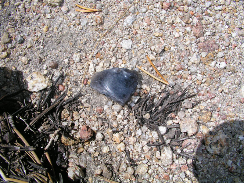
From the meadow, we walked up basin to the next meadow, this one being bigger and dryer. We stopped for a few minutes & photos then headed for the pass. The way up to the pass is steep and rugged. At the base of the steepest section, momma found an obsidian knife/blade scraper on the way up. My mom took pictures.
Daddieo taking video
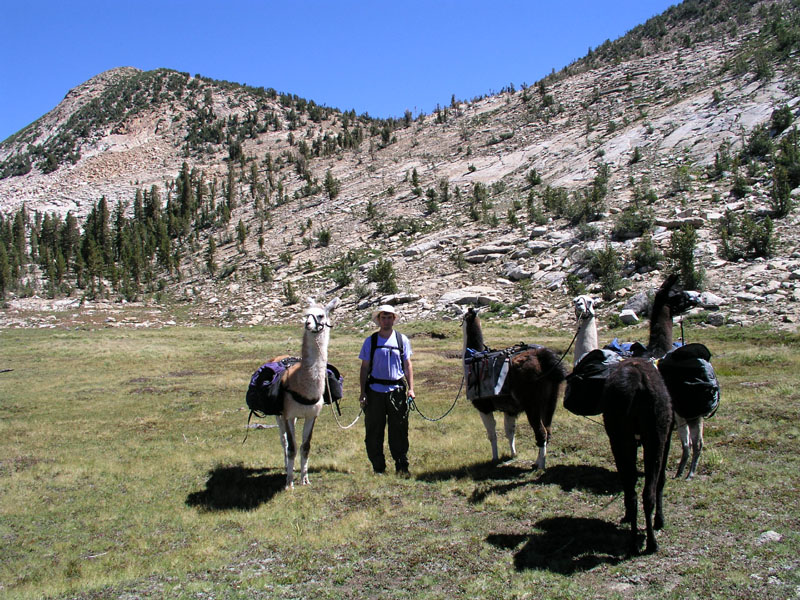
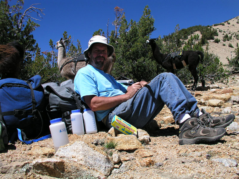
Me holding all the llamas.
The scraper.
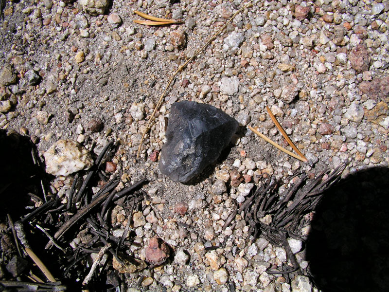
Other side of the scraper.
On top of the pass - panned out
Close-up of us on the top
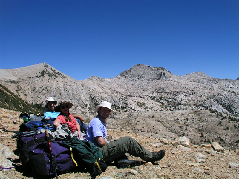
The three of us having some lunch
Daddieo cutting up some salami
Do I smell a possible Christmas card?
Momma proclaiming how much she loves this place
Panorama of the view from the pass. Scroll right to see the whole thing in all its glory.
Descending to the quartz pillow
Llamas and Quartz
Looking toward the bottom of the pillow
Daddieo pumping water
Our quartz camp
The view from the tent
The quartz meadow & llamas
What one finds underfoot
Quartz creek
A fissure in the quartz
The llamas perspective of camp
Nightfall on the quartz. Mount Hutton illuminated in the background.
Illumination on mountains to the south
A small sample of the rocks that I carried out
Day Five
Camp Location: Mc Guire Lake
Altitude: 9950 Feet
Miles Hiked: 5.5
Well we didn't end up where we had planned. Originally, we were headed for Horse head Lake but we decided once we got to Horse head that we'd rather continue down the trail to Mc Guire lake.
We woke up to a very cold morning at the quartz pillow. I had to close my sleeping bag all the way up for the first half of the night to keep warm. The second half, after my parents woke me up as they got in and out of the tent for reasons best left unmentioned, I slept with my bag partially unzipped. Mars was bright enough that I could see it quite clearly through the tent walls. The previous night, we stayed up until about 9:15 to watch the stars. The milky way was out in full force, but of course I’ve said this all before.
Anyway we woke up to a cold morning without any sun. The sun didn't get above the bluffs until nearly 9am. I searched around the pillow some more for more clear pieces to take home. I ended up with about 15 lbs of rocks in my backpack. Daddieo has 5 lbs and the llamas are carrying another 10-20lbs. Hopefully out of all of those rocks there will be one or two extra special pieces.
The quartz pillow was departed at about 10am. It was a late start but we were finding lots of great rocks so it was worth it. Our party hiked up the creek from the pillow to the big alpine meadows. I took photos and daddieo took video.
Leaving the quartz pillow
Crossing the granite divide
Down the meadow
Looking back toward Mount Hutton
Daddieo taking video & getting left behind
The llamas are thinking "has he lost his marbles?!"
Into the water
All the way across!
Crabtree Lake
Starting off across the granite
More granite
Even more granite
East Twin Buck Lake in the distance
A very photogenic rock
Starting down the hill to Roman Four Lakes
Horse head Lake. Panorama. Scroll right for the full meal deal.
Me on top of the boulder that the panorama was shot on
Boulder Camp at Horse head Lake
The llamas having a quick snack
Mc Guire Lakes and Black Cap Mountain at sunset
A productive lake means lots of fish!
Sitting around the campfire
Camp Location: Lightning Meadow
Altitude: 10275 Feet
Miles Hiked: 5
The normal sleeping in which I enjoy on these trips was dispensed with today. We woke up early to get a quick start and beat the heat crossing the vast expanses of slick rock. Mc Guire lake was left at about 830. Our group headed for the edge of the basin. At the rim, rather than descending on the official trail, a particularly poorly maintained chute of loose rock and soil, we took a hard left and picked our way along a narrow bench on the face of what amounts to a cliff with about 300 vertical feet of chances to fall.
Looking over the edge
The edge of the cliff. Looking north in the direction of courtright
Llamas doing the limbo
Mountain Meadow is a series of lush open meadows and thickly carpeted forest (carpeted with grass, the natural alternative to Astroturf!). There are several old hunting camps around the main open meadow and undoubtedly more hidden back in the trees.
The next leg of our voyage none of us had ever attempted before. On the topo maps, the route certainly looked feasible. From across the North Fork of the Kings, it looked probable, and from friends reports, it's doable. To be sure we stayed the course, I pulled out the GPS and my mom busted out her trusty surveying compass. We navigated down through grassy forests and wet meadows until our party hit a vast barren expanse of granite. The string headed straight across the blinding glairing granite toward the east. Momma and Daddieo both had sunglasses. The llamas and I were not so fortunate. After about a half mile of blinding reflected light, we got back into the forest. In this forest there were several beautiful cascading brooks which did their cascading off of the high granite bluffs above. Wandering through the forest, we found a long and narrow swale which was home to many a mighty red fir. My mommie and I walked down along the swale to see if we could find any old camps or other interesting things, but nothing of great importance was discovered.
From the red fir grove, we headed northeast up through a half hearted forest mixed with short stretches of granite toward lightning meadow. After a spell, the terrain turned mostly to broken granite interspersed with the occasional stunted tree. It was starting to get hot and the clouds were proofing up a bit. The final accent into Blackcap Basin took us across many large fault lines and fissures in the rock. My mommie got some good pictures of us navigating through one of the obstacles. We went through a couple of very nice meadows and groves of trees tucked away from sight. Had we not gone up this route, we never would have seen or known about these wonderful places.
Our group finally pulled into lightning meadow around 1pm or so. Llamas and humans stopped at the bottom end of the meadow to have some lunch and take our loads off. Once finished with lunch, Daddieo and myself scouted around the lower meadow for a good place to camp. We decided to camp at our usual spot between the lower and upper meadows. Copious amounts of evidence of other groups of llamas camping in the same site were found. It appeared that just a few brief days before, four or five llamas had camped in the same spot! The blame for this rests solely upon my mom's shoulders as she published an article several years back detailing a trip in which we camped in this very spot.
Loads were put back on the llamas and we headed across to the campsite from our lunch spot. The llamas at first thought we were going to keep walking! they sure were happy when we stopped only after a few minutes of walking. After unpacking the gear, the quadrupeds and bipeds settled into a relaxing afternoon. Momma and daddieo went into a little pond created by the creek backing up between the two meadows. I sprawled out in the tent and worked on my tan. The fabric of the tent is very much NOT UV protective.
At about 3:30pm, my sun suddenly went away. I poked my head out of the tent and looked up to see a band of dark clouds advancing west and north. Tropical moisture to be sure! remembering the last batch of tropical moisture, we put the fly on the tent and battened down the hatches. I stripped down to my skivvies and went up to just above my belly button in the water to clean up a bit. Due to the sun's absence I couldn't bring myself to go all the way. Without some rays, 10000+ feet gets mighty cold!
Pink mountains! so colorful!
Goddard Mountain on the left all lit up
Mountains to the south
Camp & dad
Day Seven
Camp Location: Lightning Meadow
Altitude: 10275 Feet
Miles Hiked: 3 or 4
We woke up to a cloudy and rainy sky this morning. The decision was made this morning that we really need a rest day for humans and llamas alike. Actually, we've decided to spend three nights here.
Last night the sky was ablaze with lightning but devoid of thunder. Daddieo says it was a lot like head lightning back in New Jersey when he was a kid. The rain came in bands today at about half an hour intervals. Finally, around 11am the clouds broke up some and we went on a walk around the lower and upper meadows. I found a nearly perfect arrowhead laying in a gully. Photos were taken.
Arrow head & mini pocket knife for perspective
Other side of the arrow head
Rainbow Lake
the cinematographer is caught on digital film & vice versa
Looking toward Confusion Lake and Confusion Pass
Dark clouds and dark rock
A large fault line which was also our makeshift decent route from Rainbow Lake
The mid-basin above Lightning Meadow and below Rainbow Lake
Southeast toward Pearl, Chappell, Cathedral, Division, Battalion, and many other great lakes
Blackcap mountain
Dead and live trees with a backdrop of clouds and mountains
Black tree on blue and white sky
Does this remind anyone else of a late 18th century French painting?
An old Sheppard’s camp in the mid-basin
Time to go watch the stars. Tomorrow we're going to day hike to Crown Basin and prepare for the three day trek out. Off to look at the stars!
Day Eight
Camp Location: Lightning Meadow
Altitude: 10275 Feet
Miles Hiked: 8 and a little bit more
Today was yet again another rest day. I got out of the tent at around 8am. There wasn’t a good reason to be up before then. We ate some granola and put the llamas out in the meadow for the day. Last night we decided to go on a day hike to midway lake. shortly after breakfast we stet off across the granite. I was volunteered to carry the backpack first. From camp, we proceeded east up a ridge to Division Lake. The lake is fairly barren, as with most of these lakes above 10500 feet. Our group hurried on across another ridge to Pearl Lake. The lake has an isthmus that reaches out from one side and nearly touches the other. Some thoughtful hippie back in the 70's laid rocks across the short shallows to allow for rock hopping. This we did and then onward to yet another ridge and Chappell Lake.
Panoram of Upper Blackcap Basin - Scroll over for full effect
Crags above Cathedral Lake. The notch on the left is a pass that I’ve hiked up to & peered over.
The good doctor just above Midway Lake
Me and my mommie
Close-up of some pinecones
Portal Lake over the edge of the cliff
Panoram of Blackcap and Crown Basins - Scroll over for full effect
Daddieo Videoing
Portal Lake and Blackcap Mountain
Looking toward Division, Pearl, and many other lakes
I am one with the world
This could be a Christmas card
Pearl Lake
We arrived back at camp at 3:30. I lounged in the tent for a while and then got my journal out and wrote a bit. Now it's dinner time.
Now I’m sitting here drinking my tea and waiting for mars to come up. Tonight is the closest it will come in 65000 years so it's a momentous occasion. Tomorrow we break camp and start the long trek out. We're more than 20 miles from the nearest road. It will take us three days to go that distance with the llamas and my mom. Her knees have been giving her lots of problems. Downhill causes just about anyone pain though, especially 20 miles worth. Mars is up. time for the nightly show that is the heavens.
Goddard capped with clouds and Little John lit up
Last rays of light in a bright and cloudy sky
Camp Location: Flemming Creek at North Fork of the Kings (next to a juniper tree)
Altitude: 8074 Feet
Miles Hiked: 10 or 11
I woke up around 6am this morning but laid in the tent and soon fell back asleep. My mom had not yet exited the building. Around 7am, my parents persuaded me to wake up, come outside, and help catch granite. He had escaped from his picket and was having a grand old time running all over hill and dale. Granite was finally corralled by bringing all the other llamas in close to camp and using the picket ropes as a makeshift fence. Granite's big adventure was over and it was time for breakfast. bread on a stick and dried fruit made up the bulk of the meal. Thanks in part to granite's escapades, we weren't able to leave camp until 10am.
From camp, we headed across the meadow and down the rocks toward the North Fork of the Kings. Right after we crossed the river, we saw two backpackers playing in a big hole. They were the first people we had seen at under two miles since Flemming Lake. We waved and they waved back but neither party spoke. If you're counting, that's something like seven or eight days not seeing a soul. Try that in a city!
Crossing the North Fork of the Kings River just below Black Cap Basin
We've made our camp right on the bank of the river next to an ancient and huge juniper tree. I took many pictures to try and capture the grandeur of the tree. Some poor fool lost his or her rope and rope bag up in one of the lowest branches of the juniper tree. By lowest branches, I mean 20-30 feet up. Undoubtedly, the rope losers were trying to hang their food in case an animal wanted to eat it. That way it'll be food on a rope! On the way down from Big Maxon Meadow, we saw monster bear prints that daddieo says easily could be from a 400 lb bear. Mighty big bear!
Juniper Camp
Another, much smaller juniper tree
Daddieo cutting grass across the river for the llamas
Our camp under the juniper tree
The riverbank
Mars is rising. Through some miracle, we can see mars fairly early in this deep canyon. Tomorrow is the end of our voyage. It will be back to civilization for me. 60 HZ hum, computers, phones, internet, work, all things that are great but at the same time horrible. Newberg also awaits me outside of this, my mountain retreat. Well enough of what is good and bad in the world outside the mountains, it's time for some high quality sleep.
Day Eleven
Camp Location: Fresno
Altitude: so low it makes my head hurt
Miles Hiked: 9
Today was the last day for us to be in the mountains. We got up fairly early so as to make it out of the canyon before the sun starts baking the exposed granite rocks which the trail winds over. Nothing too eventful happened last night once I went to bed. I had some interesting and disturbing dreams of what was waiting for me in Newberg. I should have just stayed in the mountains.
Leaving Juniper Camp
Nothing much had changed at post corral since we last had been there 10 days before. Of course, not much changes up here from year to year. A half mile past post corral, we ran into Dr. Clyde leading in a horse and mule pack string. The pack concession for this part of the world is owned by Dr. Clyde. He used to be a practicing doctor and still might be in the winter, but during the summer months Dr. Clyde runs pack strings up in the mountains. Dr. Clyde and my parents talked for a while about various things before both groups continued on their separate ways.
Once again, as we passed our normal camp in Long Meadow, the llamas were very disturbed by us not pulling off for the night. Daddieo practically had to drag Magma to keep him from going over to the camp on his own accord! Chaco, whom I was leading, doesn't know the camp, so I didn't have any problems. At the head end of Long Meadow, we stopped in the same place as we had for lunch on the first day in. The llamas were watered and staked out in the meadow while we had some food ourselves. The two backpackers whom we had seen at the top end of the North Fork and just before Post Corral hiked by while we lay in the grass and gazed up into the sky.
The grade up chamberlain’s hill was surmounted in record time as it had just dawned on the llamas that we were hiking out. At the creek crossing about two miles from the trailhead, a new sign had been nailed up. I got a very dorky picture of me standing next to it. The trailhead was finally reached and truck spotted. We unloaded and watered the llamas then the woolen mammals and those of us with hair had our separate snacks. On the way down from the mountains, we stopped a few times so I could collect some nice piece of granite to be used in a bubbler fountain at a later date.
A new wilderness regulation
And with that ends the account of my summer vacation. It may be poorly written, have words misspelled, and contain grammar of the sort that only grade-schoolers could get away with but it's my hope that this gives you, the reader, more of an understanding of what shapes my mind, body, and soul. well actually the soul thing is up for debate... But anyway, this is what I’ve grown up doing. Its what I love. I am a part of the mountains and they are a part of me.
Copyright 2004
BACK - HOME
|
Packing, Articles, and Photos
|
|
Welcome to the very bottom of the page! All material on this site, including but not limited to, text, images, and site layout and design, is copyright. Copyright © 1983-2012, Spring Creek Llama Ranch. All rights reserved. Nothing may be reproduced in part or full from this site without explicit written permission from Spring Creek Llama Ranch. All website related questions can be directed to the webmaster or webmistress. Questions about llamas, services, or other such things, can be directed to Spring Creek Llama Ranch.